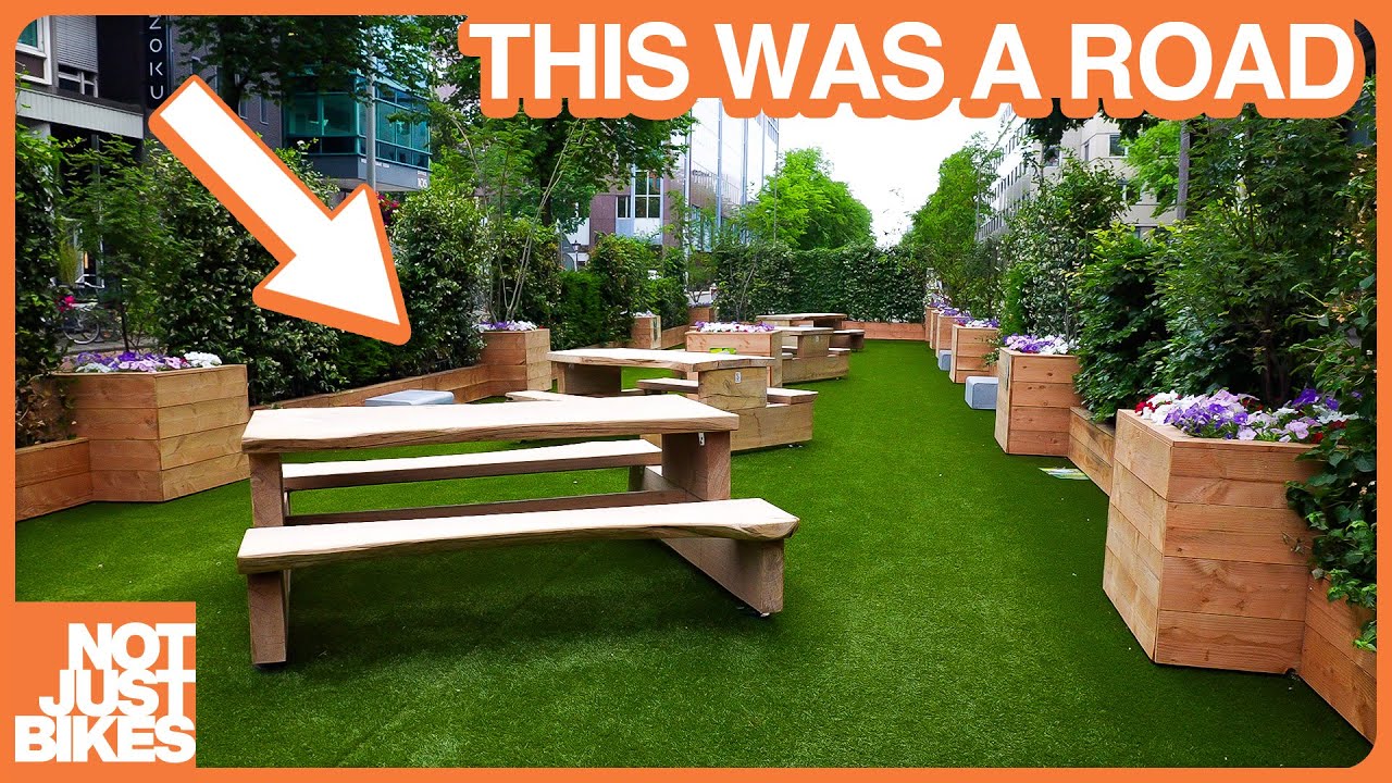
Urban planning: The built environment
 imgur.com
I'm not sure if this sub is close enough. None of the architecture ones I looked at had recent activity. But man, is brutalism ugly. There's like 2 brutalism buildings I've ever liked


Proposal Would Link Highway Funding to Zoning [https://www.planetizen.com/news/2024/02/127572-proposal-would-link-highway-funding-zoning](https://www.planetizen.com/news/2024/02/127572-proposal-would-link-highway-funding-zoning) [@urbanplanning](https://lemmy.world/c/urbanplanning)
Are there any US cities that are working on plans to use existing freight rail lines for commuter rail? As an example, I noticed when I was in Tampa that their freight rail routes (mostly owned by CSX) could actually have decent coverage for commuter rail from the suburbs to downtown Tampa. I also noticed that these freight rail lines seemed to very rarely have freight trains traveling on them. Are there any US cities that are working on developing commuter rail lines that either share these freight rail lines, or would build their own lines right alongside them using existing right of way?
Newton's new Village Center Overlay District (VCOD) zoning was passed by the City Council Last Week. The VCOD is designed to allow for the concentration of housing and commercial opportunities near transit. [https://www.newtonma.gov/government/planning/village-centers](https://www.newtonma.gov/government/planning/village-centers) [@urbanplanning](https://lemmy.world/c/urbanplanning)


 ggwash.org
<figure> </figure> [**Truck driver who killed cyclist fined $2,000**](https://www.washingtonpost.com/dc-md-va/2023/09/25/langenkamp-sarah-plea-bike-crash-bethesda/) The fatal crash, which killed diplomat Sarah Langenkamp as she was bicycling home from her children’s school in a Maryland bike lane in 2022, did not meet the threshold in Maryland law for vehicular manslaughter, according to prosecutors. The driver pleaded guilty to “causing serious injury or death to a vulnerable” person and was given the maximum fine allowed by state law. The driver’s license will be suspended up to a maximum of six months, to be determined. (This article might be behind a paywall) <em>([Dan Morse / Post](https://www.washingtonpost.com/dc-md-va/2023/09/25/langenkamp-sarah-plea-bike-crash-bethesda/))** **New flood maps for Arlington show more buildings at risk of flooding** New FEMA maps that more accurately depict flood risks in an era of climate change-driven storms and limit some uses of buildings in the highest risk areas, will take effect November 16. Although approximately 300 buildings are affected, Arlington County has relatively few properties at the highest risk of flooding, in part because the county has been buying up land in floodplains as recommended in its 1957 stormwater plan. <em>([Jo DeVoe / ARLNow](https://www.arlnow.com/2023/09/25/more-arlington-properties-are-now-located-within-floodplains-county-says/))** **Shops in Penn Branch apartment building gets grant from Amazon** The Jair Lynch-backed development of an apartment building on the rear parking lot of the Shops of Penn Branch at the corner of Pennsylvania Avenue and Branch Avenue SE has received a grant from Amazon to move forward. The project, on hold for years, will provide 189 units, with 179 of the units being affordable for those making between 60 and 80% of the area median income. (This article is behind a paywall. Disclosure: Senthil Sankaran, Principal of the Amazon Housing Equity Fund, also serves on the GGWash Board of Directors). <em>([Tristan Navera / Business Journal](https://www.bizjournals.com/washington/news/2023/09/25/shops-at-penn-branch-jair-lynch-amazon-housing.html))** **Marley Ridge condo owners, DCHA split over repairs and condition of the building** The DC Housing Authority owns nine units in the 36-unit Marley Ridge complex, an ownership stake that gives DCHA significant influence over the condo board. As many units fall into disrepair, some residents are frustrated that DCHA has not stepped up (in the absence of an active condo board president) to play more of a role in condo board decision-making. (This article is behind a paywall). <em>([Danny Nguyen / Post](https://www.washingtonpost.com/dc-md-va/2023/09/25/dc-housing-marley-ridge/))** **Alexandria City Council and architectural review board disagree on whether it’s okay to paint brick** The debate comes after the City Council overturned an Alexandria Board of Architectural Review decision that would have forced a King Street property owner to remove paint from 1960’s-era brick facade that he had painted over. <em>([Vernon Miles / ALXNow](https://www.alxnow.com/2023/09/25/city-council-bar-divided-on-whether-alexandria-should-stay-a-red-brick-town/))** **Georgetown residents petition for streatery rules and reforms** The petition to the Georgetown BID expresses concerns about parking and aesthetics and asks the BID to set and enforce rules about materials and design *and to take down streateries that sit unused for long stretches or during the off-season, among other changes. <em>([Christopher Jones / The Georgetowner](https://georgetowner.com/articles/2023/09/18/georgetown-coalition-for-public-spaces-launches-petition-drive-to-regulate-improve-streateries/))** **National Cathedral installs new stained glass windows of Black Americans marching for justice** The new windows, by Kerry James Marshall and Andrew Goldkuhle, replace windows honoring Confederate generals who led the southern rebellion in the Civil War and fought to maintain slavery in the south. A ceremony dedicating the new windows was held at the Cathedral on Saturday and attended by many Black leaders in DC, including Supreme Court Justice Ketanji Brown Jackson who read from Martin Luther Kind Jr.’s “Letter from Birmingham Jail.” <em>([Peter Smith / Afro](https://afro.com/national-cathedral-replaces-windows-honoring-confederacy-with-stained-glass-homage-to-racial-justice/))** **BWI has best day since before COVID-19 pandemic Friday** Officials at Baltimore Washington Thurgood Marshall International Airport (BWI) reported its highest ridership day since the beginning of the COVID-19 pandemic last Friday. This is a welcome sign for the airport and is attributed to several new flights at the airport. (This article is behind a paywall). <em>([Daniel Zawodny / Baltimore Banner](https://www.thebaltimorebanner.com/culture/travel/bwi-pandemic-busiest-travel-day-Y2GSTAQ5YBDUDOGVVXFWYZEIK4/))** [Comment on this article](https://ggwash.org/view/91081/breakfast-links-driver-fined-2000-for-killing-cyclist-sarah-langenkamp#comments) </em></em></em></em></em></em></em></em>
 ggwash.org
<figure> </figure> <span>Gaithersburg and Rockville are </span><span>the third- and fourth-largest cities in Maryland</span><span>, with nearly 70,000 residents each. These two Montgomery County municipalities </span><span>regularly top lists of the nation’s most diverse places</span><span> and are the backbone of the region’s biotech industry. It’s in Rockville where scientists </span><span>mapped the human genome</span><span> and </span><span>found a potential HIV cure</span><span>, and in Gaithersburg where they </span><span>discovered a COVID-19 vaccine</span><span>. What happens here has echoes that go way beyond the borders.</span> <span>That’s why we reached out to candidates in three key races to learn about their views ahead of the general election November 7. In Rockville, voters will choose a new mayor and, for the first time, six city councilmembers (up from four previously), while in Gaithersburg, voters will select three city councilmembers. </span>These are all nonpartisan races. In the general election, voters can choose up to six candidates in addition to the mayor. <span>We’re sharing the questionnaire responses we received here as a service to the public. Questionnaire responses also inform </span><span>our endorsement decisions</span><span>, which we’ll announce later this month.</span> **Wait, how does this work?** <span>Gaithersburg and Rockville have a unique distinction: both cities run their own public services, like parks, police, and zoning, unlike most of the Washington region where those things happen at the county level. Thus, the Rockville and Gaithersburg city governments have a lot of power over a big chunk of our region. Both cities also have </span><span>council-manager governments</span><span>, in which the mayor is more of a figurehead and votes as part of the City Council, which in turn appoints a city manager to run day-to-day affairs. This has a lot of similarities to </span><span>Arlington County’s government</span><span>, which has a Chair instead of a mayor. Both Rockville and Gaithersburg have at-large councils, in which everyone votes for the same candidates regardless of where they live.</span> <figure> <figcaption><i>Main Street in Gaithersburg's Kentlands neighborhood. [Image](https://www.flickr.com/photos/beyonddc/36326119665/) by Dan Malouff licensed under Creative Commons.</i></figcaption> </figure> <span>When they take office this winter, the cities’ new representatives will face some new challenges.</span> <span>Governor Wes Moore announced that he’ll move forward with plans to add four toll lanes to I-270, which runs through both cities. </span><span>Rockville opposes the project</span><span>, while </span><span>Gaithersburg supports it</span><span>. </span><span>Both cities pushed back</span><span> on Montgomery County’s newly-passed rent stabilization law, though they’ll face pressure to do something similar. In addition, Rockville’s council will have to appoint a new city manager, </span><span>who resigned in August</span><span> due to performance issues. </span> <span>Voters in Rockville will also decide on four ballot questions, including whether to allow 16-year-olds and non-citizens to vote, as well as setting term limits for councilmembers and creating representative districts. </span> <span>Both Rockville and Gaithersburg will have vote-by-mail as an option. In Rockville, all registered voters </span><span>will receive a ballot in the mail</span><span> by October 13, while in Gaithersburg, voters have to </span><span>request a ballot be mailed to them</span><span>. In both cities, voters can mail their ballots back, place them in a drop box, or vote in person. Here’s information on how to do that in </span><span>Rockville</span><span> and </span><span>Gaithersburg</span><span>.</span> **Here’s what the candidates had to say** <span>Below we are excited to share the questionnaire responses we received, organized by race. </span>**Click on a linked name to view that applicant’s questionnaire.** If a name is not linked, it’s because that candidate did not submit a questionnaire. <table> <tbody> <tr> <td>Rockville Mayor</td> <td>Rockville City Council</td> <td>Gaithersburg City Council</td> </tr> <tr> <td> <li><span>Monique Ashton</span> </li><li><span>Mark Pierzchala</span> </li></td> <td> <li><span>Danniel Belay</span> </li><li><span>Kate Fulton</span> </li><li><span>Richard Gottfried</span> </li><li><span>Harold Hodges</span> </li><li><span>Barry Jackson</span> </li><li><span>Ricky Mui</span> </li><li><span>David Myles</span> </li><li><span>Anita Neal Powell</span> </li><li><span>Paul Scott</span> </li><li><span>Izola Shaw</span> </li><li><span>Marissa Valeri</span> </li><li><span>Adam Van Grack</span> </li></td> <td> <li><span>Neil Harris</span> </li><li><span>Yamil Hernández</span> </li><li><span>Daniel Lukomsky</span> </li><li><span>Shanika Whitehurst</span> </li><li><span>Omodamola Williams</span> </li><li><span>Robert Wu</span> </li></td> </tr> </tbody> </table> <span>If you’d like to learn more about the candidates, you can attend one of </span><span>three candidate forums in Rockville</span><span> this fall, while Gaithersburg has </span><span>bios for each candidate</span><span> on the city website. WABA also has questionnaire responses for </span><span>Rockville</span><span> and </span><span>Gaithersburg</span><span> candidates. And don’t forget, our Elections Hub is your one-stop shop for questionnaires, endorsements process details, and our endorsements themselves. Access the hub anytime from the </span><span>“2023 Elections” link</span><span> in the upper right corner of our website.</span> <i>Top image: [Photo](https://www.flickr.com/photos/beyonddc/24344051093/in/photolist-6ZuVYm-6ZuVW9-daJ3YS-cLsHt9-D6cCfR-cLsK6E-dAePcg-dAePdn-cLsFZo-DUmuG2-D5SRK5-BExhau-cLsFxJ-cLsHRS-cLsPUd-9jNoov-cLsQnj-9jRu1A-cLsN3d-cLsF2b-cLsR3w-cLsGkW-fpEQD3-87dWdz-a7k4fH-cLsNvU-cLsGRG-cLsKEW-cLsJk9-cLsLaU-cLsLBN-SPqgeW-cLsMDY-cLsJGu-cLsNXY-cLsM51-9jRu7f-cLkD8o-9jNoZ8-9jRtHf-E1gWwN-D6cZPn-9jNovM-9M2m4y-cLsPqU-a7juN8-cLGeZm-7ar79z-7ar7eg-7auVoU) of Rockville Town Center by Dan Malouff. </i> [Comment on this article](https://ggwash.org/view/91071/rockville-gaithersburg-2023-election#comments)
 ggwash.org
<figure> </figure> [**Historic Preservation Office recommends that HPRB approve office-to-residential conversion near Dupont Circle**](https://dc.urbanturf.com/articles/blog/hpo_recommends_approval_for_157-unit_office-to-residential_conversion_propo/21499) Located at 1625 Massachusetts Avenue NW, the office building will move one step closer toward becoming 157 apartments, assuming the Historic Preservation Review Board follows the recommendation of the Historic Preservation Office and votes to approve the project. The exterior of the building will remain unchanged as it undergoes renovations. <em>([UrbanTurf](https://dc.urbanturf.com/articles/blog/hpo_recommends_approval_for_157-unit_office-to-residential_conversion_propo/21499))** **Events DC expected to help fund renovation of the last unfinished piece of Nationals Park** Events DC is set to spend $3 million to fit out the interior of a space at the ballpark that was long designated for retail and entertainment, near Potomac Avenue and First Street SE. The space was never finished, and last September, the latest in a series of temporary certificates of occupancy expired, threatening to shut down the entire park for noncompliance. (This article is behind a paywall) <em>([Tristan Navera / Business Journal](https://www.bizjournals.com/washington/news/2023/09/22/washington-nationals-park-retail-events-dc.html?cx_testId=40&cx_testVariant=cx_4&cx_artPos=4#cxrecs_s))** **Several West Baltimore homeowners feel trapped in poorly constructed new homes** Homeowners in a west Baltimore development, many of whom are Black, face issues like mold, uneven floors, cracked foundations, and ill-fitting windows in homes that are just a few years old. Most of the homeowners purchased their houses with the help of HUD funding and if they sell before owning the homes for ten years, they will lose some of their equity. (This article is behind a paywall) <em>([Hallie Miller / Baltimore Banner](https://www.thebaltimorebanner.com/community/housing/uplands-home-problems-3EMEF6XAFJAAZJQXWXOSFBFFAM/))** **Zoning, transportation among the big issues Virginians face in the polls** All 100 House of Delegate seats and 40 Senate seats are up for grabs in Virginia General Assembly elections this fall. Combined with local government races, the election is sure to have an impact in hot-button issues like zoning, transportation, and education. <em>([Margaret Barthel / DCist](https://dcist.com/story/23/09/21/2023-northern-virginia-election-guide/))** **Apartment construction pipeline for DC area loses some steam** The number of apartment units under construction in the Washington region has declined thanks to high construction costs and difficulties securing financing. The decline comes as the region continues to face a housing shortage. <em>([Brianna Crane / Axios](https://www.axios.com/local/washington-dc/2023/09/23/new-apartments-washington-dc))** **Interior elements of new office building in Reston mimic Capitol Beltway** A new office building at Reston Station has elements of its interior based on the Capitol Beltway. Namely, it utilizes walking paths around each floor that feel like the highway. The new office also includes a jazz cafe that’s inspired by DC’s jazz scene. <em>([Fatimah Waseem / FFXnow](https://www.ffxnow.com/2023/09/22/software-company-opens-new-capital-beltway-inspired-offices-at-reston-station/))** [Comment on this article](https://ggwash.org/view/91064/breakfast-links-dupont-office-to-residential-conversion-heads-toward-historic-preservation-review-board-vote#comments) </em></em></em></em></em></em>
 ggwash.org
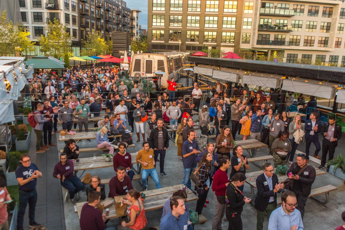
<figure> </figure> It’s hard to believe, but the days are cooling down and the leaves are starting to change color—that means it’s time for our Fall Mixer at Metrobar! This casual event is the biggest gathering of transit fans and housing advocates around and you will have the chance to connect with hundreds of like-minded people. Bring your friends and family and join GGWash on Wednesday, September 27 for a night of fun in the fresh air—no SmarTrip card required! If the $30 ticket price doesn’t seem doable, you can [use this form](https://docs.google.com/forms/d/e/1FAIpQLScJO5ngNDNFqdetoCUTqlmtSCa1Sjx4UEgkbMBoEQVZxT7hXQ/viewform?usp=sharing) to request one of our pay-it-forward tickets or to sign up to volunteer. [Learn more & RSVP here.](https://ggwash.org/event/ggwash-fall-mixer-2023) - Date: Wednesday, September 27, 2023 - Time: 5:00 pm - 9:00 pm - Location: Metrobar <h3>**Tuesday, September 26:**</h3> **Volunteer to clean up our waterways: **Anacostia Riverkeeper and Washington Gas are hosting a [cleanup](https://www.anacostiariverkeeper.org/event/clean-waterways-cleanup-with-washington-gas-stadium-armory-metro/) from the Stadium-Armory Metro to Kingman Island. At Kingman Island you will sort and weigh the trash that was picked up along the way. The goal is to stop trash on the ground from entering the river. All necessary equipment will be provided. They recommend that you wear clothes you don’t mind getting dirty and closed-toe shoes. The cleanup happens rain or shine. All ages welcome. [Learn more & RSVP here.](https://www.eventbrite.com/e/clean-waterways-cleanup-with-washington-gas-stadium-armory-metro-tickets-706871259967) - Date: Tuesday, September 26, 2023 - Time: 3:45 pm - 6:30 pm - Location: Stadium-Armory Metro Station, 100 19th Street SE, Washington, DC 20003 <h3>**Thursday, September 28:**</h3> **Celebrate the new Crystal City Bike Network with a bike ride: **The People Before Cars Coalition, a partnership of local stakeholders established by the National Landing Business Improvement District (BID), works to create safer and more accessible transit networks around National Landing. They want to celebrate the newly implemented Crystal City Bike Network (CCBN), and for you to join them! The CCBN is an initiative in Arlington County to decrease the number of bicycle facilities in Crystal City by ensuring the bicycle lanes are protected and buffered. The ride starts at Conte’s Bike Shop and ends at The Freshman for a happy hour. They will be providing complimentary bike valet at the happy hour. [Learn more & RSVP here.](https://www.eventbrite.com/e/the-people-before-cars-coalition-hosts-crystal-city-bike-ride-happy-hour-tickets-709732457887) - Date: Thursday, September 28, 2023 - Time: 5:00 pm - 7:30 pm - Location: Conte’s Bike Shop, 1350 S Eads St, Arlington, VA 22202 <h3>**Friday, September 29:**</h3> **Attend a webinar on reducing roadway injuries and death in Fairfax: **George Mason University’s Regional Elected Leaders Initiative (RELI) is hosting a webinar on how Fairfax County can work towards reducing roadway injuries and deaths. There will be a panel with four experts answering questions like: How are enforcement, engineering, and education strategies being utilized to reduce risk of injury or death to roadway users around popular gathering places (libraries, parks, schools) in Fairfax? How can those specific locations be evaluated and what implications are there for similar locations? Who gets to choose what short and long term mitigations are the most appropriate? And, what local- or state-level policy changes could make the roads safer for everyone in Northern Virginia? [Learn more & RSVP here.](https://gmu.zoom.us/webinar/register/WN_AHY_2LYiTPWt1AbQ8Iqsow#/registration) - Date: Friday, September 29, 2023 - Time: 12:00 pm - 1:15 pm - Location: Virtual via Zoom **Learn about climate change’s connection to household financial wellbeing: **Climate change fueled events, such as heat waves and floods, have been shown to impose significant financial costs on households across the US. In order to help understand the importance of this connection, the Urban Institute is hosting a [hybrid](https://www.urban.org/events/climate-change-and-household-financial-well-being-understanding-risk-and-building-resilience) webinar on understanding risk and building resilience when it comes to climate change and household financial wellbeing. The webinar will explore the causes and consequences of climate-related financial stress, including a discussion with the assistant secretary of the US Department of the Treasury. The panel section of the webinar will feature several professionals who will expand on that discussion by discussing the opportunities that households, policymakers, and communities have to prepare and respond to these climate driven financial burdens. [Learn more & RSVP here.](https://event.on24.com/wcc/r/4345164/B7880BE2072594A97B248D4ED8E01725) - Date: Friday, September 29, 2023 - Time: 1:00 pm - 2:15 pm - Location: Urban Institute, 500 L’Enfant Plaza SW, Washington, DC 20024 (in-person) or Virtually **Join the citywide Hunt: **It’s a food and housing puzzle hunt and you’re invited to join! Local non-profit Game Genius is hosting their annual citywide puzzle hunt, and this year’s theme is Food and Housing. Form your team, solve puzzles, and learn about local organizations and changemakers in the process! The games begin when the first clue is dropped on Friday, September 29 and can be played until the evening of Monday, October 9. You can either compete against the clock for a grand prize that is awarded based on speed and accuracy or you can solve the puzzle at your own pace. [Learn more & buy tickets here](https://www.gamegenius.org/districthunt). - Date: Friday, September 29, 2023 - Time: 6:00 pm - Location: Within the Washington, DC, boundary <h3>**Saturday, September 30:**</h3> **Take a community ride to an ice cream shop: **Hill Family Biking is back with another community ride. Join them on Saturday, September 30 to ride your bike around Navy Yard: past Audi Field, Nationals Park, and the new Frederick Douglass Memorial Bridge. The route includes a block of the new M St SE two-way protected bike lanes! The ride ends at Ice Cream Jubilee at Yards Park. There will be volunteer marshals and an MPD bike team participating in the ride to make sure no one gets separated from the group. Additionally, there will be tools available for you to use for bike maintenance if you arrive fifteen minutes early, as well as experienced amateur bike mechanics on site to assist you. [Learn more & RSVP here.](https://www.eventbrite.com/e/hill-family-biking-new-m-st-se-bike-lane-explore-tickets-687926214827?aff=oddtdtcreator) - Date: Saturday, September 30, 2023 - Time: 4:00 pm - 5:30 pm - Location: Garfield Park, 3rd & G St SE, Washington, DC 20003 (meet on the 3rd St SE side by the tennis courts) [**View more upcoming events on our calendar!**](https://ggwash.org/calendar) **Community members submit events for inclusion on our events posts and in our events calendar. **[**Submit your event here.**](https://ggwash.org/calendar/submit) **Submissions may be edited for context and clarity.** [Comment on this article](https://ggwash.org/view/91070/events-usher-in-fall-at-the-ggwash-fall-mixer#comments)
 ggwash.org
<figure> </figure> <p>**A version of this article originally appeared on [Streetsblog](https://usa.streetsblog.org/2023/09/20/study-how-low-income-people-really-use-micromobility).** </p><p><span>Low-income people are using shared micromobility a lot like they use public transit, a new study finds — and researchers think cities should thoroughly embrace (and subsidize) the mode as part of the larger ecosystem of buses and trains.</span> </p><p><span>Researchers at </span><span>Monash University, </span><span>using survey data from micromobility giant Lime users across all income levels in the US, Australia, and New Zealand, dug deeper into how low-income people uniquely use the company’s vehicles.</span> </p><p><span>Participants in the Lime Access program, which grants discounts of around “70 or 80 percent” to riders who qualify, were significantly more likely to list essential reasons like “shopping” for groceries (35 percent) and “commuting” (31 percent) than non-Access riders, 11 and 21 percent of whom rode to complete errands or go to work, respectively.</span> </p><p><span>The discount recipients were also highly </span>**<span>unlikely </span>**<span>to go use bikes and scooters for non-essential reasons like social outings (12 percent), “joy-riding” (9 percent) or exploring (2 percent), quashing the stereotype that all micromobility trips are spontaneously generated. And a whopping 44 percent of their trips connected to a traditional transit ride, compared to just 23 percent of people who paid full price.</span> </p><p><span>Perhaps the most surprising findings, though, were riders’</span>**<span> qualitative</span>**<span> responses about what micromobility meant to them, and how their lives were made better by having access to affordable ways to get around without a car. Calvin Thigpen — director of policy research for Lime and co-author of the report — says he was particularly moved by the number of riders with invisible disabilities who said Lime Access helped them get where they needed to go, even when local transit schedules didn’t meet their needs.</span> </p><p><span>“Something that really shone through in some of these quotes … was how much people really needed this program, and really came to rely on it,” said Thigpen. “It’s easy for people to think of Lime and other shared scooter options like they’re just toys that people just use for fun. And that’s just really not the case. People are using this to get around for pivotal trips; they are heavy, often daily users.”</span> </p><p><span> </span></p><figure> <figcaption><i>Graphic: Monash University/Lime </i></figcaption> </figure> <p><span>About 62 percent of cities with micromobility programs today require operators to meet at least one equity requirement in order to run fleets, and discount programs like Lime Access have become an increasingly popular way for them to do it; in Chicago alone, Lime has offered roughly 400,000 discounted rides so far this year, and saved participants a staggering $1.1 million.</span> </p><p><span>And according to the new analysis, all that money is buying something valuable: better daily mobility for the people who are least likely to own private cars.</span> </p><p><span>Those inspiring benefits, though, come at a cost that micromobility companies’ razor-thin margins can’t always afford. </span><span>Houston’s B-Cycle</span><span> and </span><span>Minneapolis’s Nice Ride</span><span> are just a few of the prominent bikeshare outfits to shut down in the wake of recent financial difficulties, and the researchers say the entire micromobility industry is grappling with “potentially existential risks to [their] ongoing operations” while working to expand access to the riders who rely on them most.</span> </p><p><span>The roughly $7 million that Lime handed out in equity-focused discounts in 2022 didn’t stop the company from achieving its </span><span>first full profitable year</span><span>. But Thigpen said the company could do a lot more for low-income Americans if cities simply recognized the impact shared micromobility has on their lives — and treated it as an important component of the transit universe.</span> </p><p><span>“I think that’s something that would be very valuable,” Thigpen added. “It’s something that transit agencies already do when they contract out to private bus operators, or even private train operators. This would not be some novel thing; it will just be a new mode, being integrated into transit. …At the end of the day that’s really our goal, right? Our mission is to achieve a future of transportation that’s shared, affordable, and sustainable; I think [making micromobility] a bigger part of transit is a really, really valuable approach.”</span> </p><h5>**What the transitification of micromobility might look like**</h5> <p><span>Enhancing public support for scooter and bikeshare, Thigpen stressed, can take many forms. Cities like Denver have completely waived program fees for micromobility operators in exchange for them meeting robust equity benchmarks and building parking corrals to keep scooters off sidewalks, while others, like Washington, DC, offer them scaled refunds on that fee based on how what percentage of miles low-income riders travel compared to the overall rider pool.</span> </p><p><span>He also suggests that the </span><span>growing list of US cities offering residents rebates to buy their own e-bikes</span><span> could expand their programs to offer e-bikeshare memberships to low-income riders — particularly for people who have no secure, convenient place to store an e-cycle of their own, don’t want to lug a heavy e-scooter up a set of apartment stairs, or can’t afford the expense of fixing an e-vehicle when it breaks.</span> </p><p><span>“It seems like every city and state is getting on board with e-bike rebates these days,” Thigpen added. “And I think it’s worth asking the question: Are they meeting the needs of everyone, and is there a space for shared programs [to participate]? Could [offering shared e-mobility memberships] meet the needs of lower income riders, disabled riders, people who live in places where they can’t securely lock up a vehicle? That’s my speculation, but it’s definitely worth further study.”</span> </p><p><span> </span></p><figure> <figcaption><i>Graphic: Monash University/Lime </i></figcaption> </figure> <p><span>Thigpen acknowledged that cost is far from the only barrier to micromobilty that low-income riders face, and that Lime </span>**<span>and </span>**<span>cities can do more to help.</span> </p><p><span>Most Access riders (54 percent) reported frustration with not being able to find a vehicle when they needed it, suggesting that cities may need to relax fleet caps, and that operators may need to do a better job of reshuffling bikes and scooters into the neighborhoods where people need them most. More than a third of them (36 percent) said that they couldn’t always take micromobility to the places they needed to go, thanks to slow- and no-ride zones that automatically throttle vehicle speeds when they passed invisible digital borders called “geofences.”</span> </p><p><span>And 75% of Lime riders had never even </span>**<span>heard</span>**<span> of Access, including some who qualified for the program, but hadn’t signed up. Others struggled to sign up — something the company says it’s addressing with targeted awareness campaigns through companies like </span><span>Propel</span><span> and a newly streamlined, “near-instantaneous” application process. (The researchers didn’t ask about whether fear of traffic violence or lack of bike lanes were significant barriers for Access riders, but other analysis has found that’s </span><span>definitely a factor</span><span> for would-be micromobility users on the whole.)</span> </p><p><span>However cities move forward, Thigpen stressed that it’s critical that they continue to study how micromobility can work for residents who are poor, living with mobility challenges, or simply sick and tired of waiting for buses that never come.</span> </p><p><span>“Lime is essentially another transit option,” he added. “We’re not a bus; we are not a train. But people use us in the same fashion that you would a bus or a train.”</span> [Comment on this article](https://ggwash.org/view/91062/study-how-low-income-people-really-use-micromobility#comments) </p>
 ggwash.org
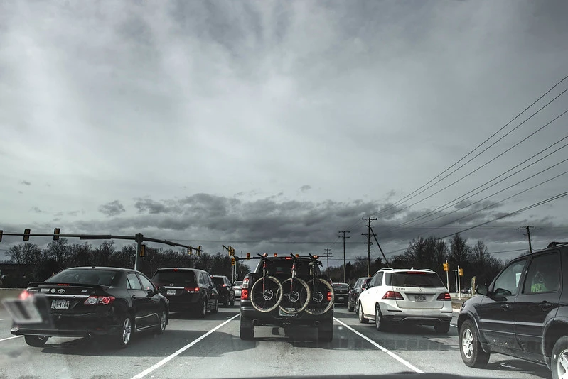
<figure> </figure> [**Car congestion is worsening in the region while rail transit ridership lags**](https://www.washingtonpost.com/transportation/2023/09/22/dc-commute-cars-traffic-metro/) As more people return to in-person work, more are choosing to drive, leading to congestion that increases trip times by as much as 20 percent on weekdays and 25 percent on weekends. Meanwhile, although bus ridership has nearly recovered to pre-pandemic levels, ridership on the region’s rail systems continues to lag. (This article may be behind a paywall). <em>([Post](https://www.washingtonpost.com/transportation/2023/09/22/dc-commute-cars-traffic-metro/))** **House Oversight Committee passes bill authorizing redevelopment of RFK stadium** The RFK Memorial Stadium Campus Revitalization Act has made it through the House Oversight Committee and is now awaiting a final vote on the House floor. If passed, the bill will extend the District’s lease on the 190-acre site and allow more flexibility in terms of what can be developed on the site. Mayor Bowser has expressed strong support for redeveloping the site with a new Commanders stadium, while members of the DC Council are divided about what should be built. (**Disclosure: Eleanor Barker’s partner works for Congresswoman Norton, who co-sponsored the bill.**) <em>([Matt Blitz / DCist](https://dcist.com/story/23/09/21/bill-dc-rfk-stadium-site-lease-advances-house-oversight-committee/))** **Alexandria’s City Council set to support Arlington’s application for Shirlington Transit Center expansion** Next week, the Alexandria City Council will vote to support Arlington’s funding application to the Northern Virginia Transportation Authority for an expanded transit center in Shirlington. Officials in Alexandria believe the city’s own residents will benefit from the expansion, as additional buses would also serve Alexandria. <em>([Vernon Miles / ALXNow](https://www.alxnow.com/2023/09/20/alexandria-likely-to-throw-its-weight-behind-arlington-transit-project/))** **More Montgomery County residents are facing food insecurity** Montgomery County residents are facing food insecurity at levels higher than during the peak of the pandemic. The end of additional SNAP benefits, increased cost of living, and other factors have exacerbated the issue. Furthermore, those affected are disproportionately people of color. <em>([Julie Rasicot / MoCo360](https://moco360.media/2023/09/21/more-montgomery-county-residents-are-facing-food-insecurity-than-at-the-height-of-the-pandemic/))** **Arlington set to allocate additional funds to Bluemont Junction Trail** The Arlington County Board will consider allocating additional funds to the Bluemont Junction Trail safety project. If approved, the funds will go to redeveloping pedestrian and cyclist intersections and improving trails for people with disabilities. <em>([James Jarvis / ARLNow](https://www.arlnow.com/2023/09/21/county-board-poised-to-allocate-funding-for-more-upgrades-to-bluemont-junction-trail/))** **Maryland resumes bidding process for BWI concessions contract** Maryland has resumed the bidding process for a new contractor to run BWI’s concessions. Seven months ago, the state suspended the search amid accusations that the process had been rigged, but new terms and conditions have allowed the process to resume. <em>([Josh Kurtz / Maryland Matters](https://www.marylandmatters.org/2023/09/20/state-restarts-controversial-bidding-process-for-bwi-airport-concessions-contract/))** [Comment on this article](https://ggwash.org/view/91051/breakfast-links-car-commutes-worsen-as-more-return-to-in-person-work#comments) </em></em></em></em></em></em>
 ggwash.org
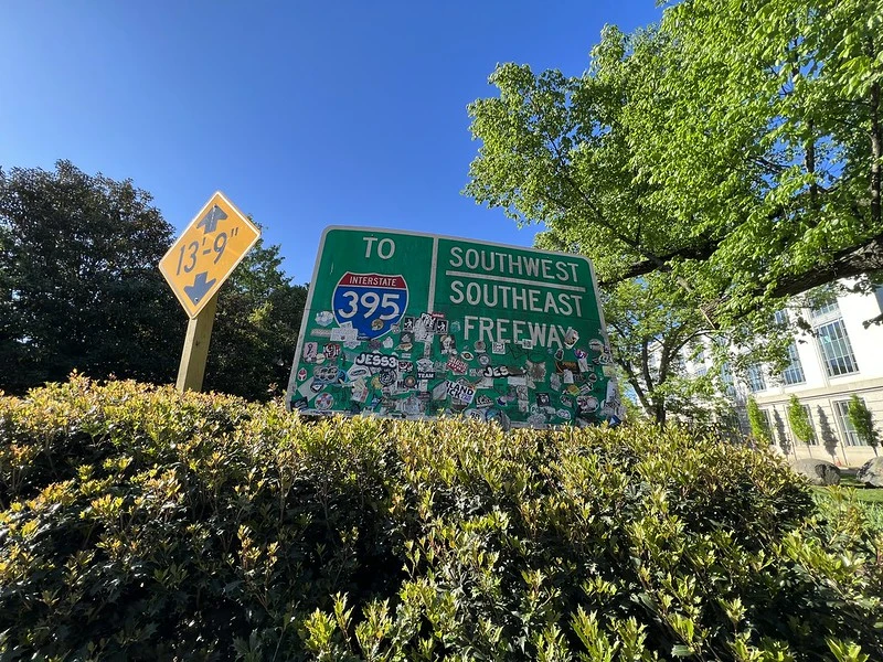
<figure> </figure> [**FHWA gets involved as DDOT delays persist in replacing confusing Southeast/Southwest Freeway overhead signs**](https://wtop.com/dc-transit/2023/09/freeway-frenzy-on-i-395-persists-amid-years-long-delay-in-updating-dc-signs/) Two years after the Federal Highway Administration (FHWA) approved DDOT’s request to renumber portions of I-395 to reduce driver confusion and crashes near the 3rd Street Tunnel exit, some online apps have updated the numbering but DDOT’s overhead signs remain outdated. FHWA has approached DDOT to push for timely sign replacement. <em>([Dave Dildine / WTOP](https://wtop.com/dc-transit/2023/09/freeway-frenzy-on-i-395-persists-amid-years-long-delay-in-updating-dc-signs/))** **“Extreme lack” of existing and newly built homes on the market contributing to rising prices in region** While high interest rates have caused homeowners to hang onto their current homes with locked-in low rates, a shortage in new construction is also driving up housing prices. The Washington region has 49% fewer newly constructed homes on the market than in 2015. (This article is behind a paywall) <em>([Michele Lerner / Post](https://www.washingtonpost.com/business/2023/09/20/new-construction-remains-low/))** **Pedestrians to be better protected under new Arlington Country crosswalk ordinance requiring drivers to stop** The Arlington Country Board is set to move forward on an ordinance that requires drivers to come to a full stop for pedestrians in the crosswalk, whereas previous county code only required them to yield. One-third of fatal crashes in Arlington between 2018-2022 involved a pedestrian. <em>([Jo DeVoe / ARLnow](https://www.arlnow.com/2023/09/20/county-poised-to-require-drivers-to-come-to-a-full-stop-for-pedestrians-in-crosswalks/))** **West Baltimore neighborhood stuck with vacant properties due to 17-year-old contract between city and developer** In 2006, the City of Baltimore struck a deal with developer La Cité, in which the city would assemble parcels of land and demolish homes in the historically Black Poppleton neighborhood that La Cité would then redevelop. La Cité hasn’t moved forward with any redevelopment and the city remains the owner of now-vacant parcels and is bound to the contract terms, frustrating residents who want to see the community revitalized. (This article is behind a paywall). <em>([Giacomo Bologna / Baltimore Sun](https://www.baltimoresun.com/business/real-estate/bs-bz-poppleton-community-20230920-yrshc34rhbf5hknq55bewqyizu-story.html))** **Sugarloaf Mountain closed to hikers following a burglary; some suggest connection to ongoing zoning debate** Nonprofit organization Stronghold closed Sugarloaf Mountain to the public following a burglary attempt in August, defying the mandate to provide public access and frustrating hikers, with a petition to reopen garnering 3,000 signatures. Some say that Stronghold is simply reevaluating its security measures, while others see this as a move by Stronghold to demonstrate to the county that it can shutter the mountain if ongoing zoning reforms don’t go Stronghold’s way. (This article is behind a paywall). <em>([Baltimore Sun](https://www.baltimoresun.com/maryland/bs-wp-sugarloaf-mountain-closure-20230920-bgvgtewyfncsde6fg74xqn3fgm-story.html))** **Calls renewed for paving Palisades Trolley Trail to create bike path** Calls for paving the underused Palisades Trolley Trail to create a 10-foot-wide bike path have resurfaced with the opening of a new high school in DC’s Palisades neighborhood. Advocates argue that a paved path would provide a safe route for students and residents while reducing traffic congestion. Plans also suggest the trail could eventually connect to Georgetown, requiring the purchase and restoration of the dilapidated Foundry Branch Trestle Bridge. <em>([Luke Lukert / WTOP](https://wtop.com/dc/2023/09/calls-renewed-for-woefully-underused-trail-to-become-bike-path-to-new-dc-high-school/))** [Comment on this article](https://ggwash.org/view/91038/breakfast-links-delays-in-replacing-southeast-southwest-freeway-signage-continue#comments) </em></em></em></em></em></em>
 ggwash.org
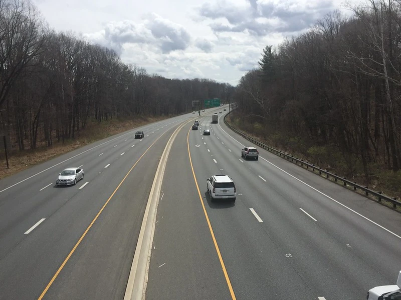
<figure> </figure> <span>After years of backlash against former Maryland Gov. Larry Hogan’s Beltway widening plan, in August the Moore administration introduced a modified proposal to address congestion. The new plan nixes the controversial public-private partnership, which would allow a private company to profit from tolls decades into the future. Nonetheless, it still entails road-widening, which critics point out induces more traffic demand. They argue the state should improve transit instead.</span> <span>In 2017, Hogan announced a </span><span>$9 billion plan for a massive widening</span><span> of the Capital Beltway, I-270, and the Baltimore-Washington Parkway, to be financed largely by a private company. Civic and environmental groups and officials, especially in Montgomery and Prince George’s counties, feared destruction of homes and parkland and increased traffic. The </span><span>plan was eventually scaled back</span><span>, and that version was approved in a </span><span>2022 Federal Highway Administration Record of Decision</span><span>. </span> <span>In 2023, Gov. Wes Moore’s new administration announced it was moving </span><span>ahead with another modified version</span><span>. It would </span><span>rebuild the American Legion Bridge and add two lanes</span><span> in each direction from the bridge along the Beltway to the I-270 spur in the first two phases, with a third phase to follow. </span> <span>Under the new $4 billion plan, the State of Maryland has applied for a $2.4 billion federal grant to move forward.</span> **Wider highways equal…environmental benefits?** <span>Moore’s decision has </span><span>spurred opposition</span><span> from environmental and citizens’ groups.</span> <span>“We’re in a climate crisis, and the number one source of climate pollution is the transportation sector. And we will not convert to electric vehicles fast enough,” said Brian O’Malley, president and CEO of the Central Maryland Transportation Alliance. “This still is primarily a plan to bring federal funding and state funding to widen highways.” </span> <span>Opponents call instead for a mixture of better transit, more walkability and bikeability, and high occupancy vehicle (HOV) lanes, pointing out that </span><span>widening roads almost always leads to more traffic</span><span> and a return to congestion within a few years. </span> <span>The Record of Decision does show a positive climate outcome from adding lanes, stating that “Greenhouse gases (GHG) emissions with the Selected Alternative are expected to decline in the Opening (2025) and Design (2045) years for all GHG pollutants.” However, a </span><span>host of studies, along with real-world experience</span><span>, show that road-widening almost always induces additional traffic and increases vehicle miles traveled, ultimately worsening the climate crisis. </span> <span>The Maryland Sierra Club, in explaining its joint </span><span>lawsuit to stop the project,</span><span> argues that, “MDOT is not disclosing details about its claim that the toll lanes will reduce traffic, while the US Department of Transportation said it could not confirm the ‘plausibility’ or ‘validity’ of MDOT’s traffic findings.” The lawsuit also claims that the project threatens historic and environmentally sensitive sites.</span> <span>Maryland Department of Transportation Secretary Paul Wiedefeld described the Moore plan as friendly to transit and shared vehicles. </span> <span>“The biggest difference is our focus is on transit and other opportunities, particularly demand management,” Wiedefeld said. “We are focusing on that as the starting point … how do we promote people to not use single-occupancy cars?” </span> <span>Under the new plan, added lanes will be free for car- and van pools. Bus service will be greatly improved, partly through greater cooperation with Virginia in connecting lines across the bridge. Near-term options include express buses or bus rapid transit (BRT) to run on the new lanes, and Wiedefeld also pointed to “eventually looking at higher use alternatives. The bridge would be designed to support heavier vehicles” such as rail. Wiedefeld also said demand management — charging different amounts depending on usage — would keep traffic flowing.</span> <span>At least one </span><span>fierce opponent of the original plan</span><span> supports the Moore version. </span> <span>Montgomery County Executive Marc Elrich argued that, by </span><span>starting work at the American Legion Bridge</span><span>, the Moore plan is tackling the biggest choke point first, positioning it to avoid “terrible bottlenecks in Hogan’s plan,” for instance where the lanes narrow on I-270. Elrich also lauds the decision to ask for federal money rather than relying on a private company.</span> **Moore’s plan leaves the door open to more widening** <span>The future scope of the Moore plan is uncertain. That’s because the modified plan retains the 2022 Record of Decision, which allows all the capacity of Hogan’s version. Elrich emphasized that this is a maximum and the road widening won’t necessarily be anywhere near that capacity. </span> <span>The first two phases will widen a section of Beltway lanes, and this could be followed by modest expansion on I-270 using public money, or a large expansion which could entail a return to controversial private financing. </span> <span>“We don’t ever want to negate the possibility for other funding mechanisms, but the reality is right now we are focusing on the public financing option,” Wiedefeld said. Wiedefeld and Elrich both stressed that the plan could change based on community input and other factors.</span> <span>However, critics such as Kyle Hart, Mid-Atlantic Field Representative at the National Parks Conservation Association, argued that maintaining the current Record of Decision invites an environmentally and socially disastrous future. Hart said the process was flawed from the beginning of the Hogan administration, when transit-based solutions were scrapped without real consideration, and this has continued in the Moore version. </span> <span>“If you followed the whole [environmental impact statement] project from the beginning, there was never any serious consideration of anything other than toll lanes in either direction. They never did a comprehensive study on reversible lanes, on HOV lanes, on transit alternatives … they always had this eye toward adding toll lanes,” Hart said. </span> <span>Hart argues it would be better to start from scratch. However, that would necessitate “another two to three year process,” said Elrich. </span> <span>Opponents of the project argue lane widening in one area invariably leads to choke points elsewhere, which leads to calls for further widening upstream or downstream. </span> <span>“When you widen to solve a bottleneck, say where 495 and 270 intersect, then that induces more travel, and then you have bottlenecks in other places that require road widening at major arterials up and down 270 and at other pinch points around 494,” O’Malley said. “That’s been the experience since ‘60s, there’s always more bottlenecks, and the net result is far more traffic.” </span> <span>The inevitable result, in this analysis, is future calls for more lanes in a cycle of unending widening. </span> <span>Hart also pointed out that forests improve air quality and the plan would remove three acres of parkland permanently, with over 15 acres gone or damaged for the next 50 or 60 years. This includes old-growth forest that will never fully recover, habitat crucial to many species like the endangered long-eared bat, said Hart.</span> <span>Elrich, however, argued that the Moore plan provides necessary relief for an untenable traffic situation. </span> <span>“It is a mess today, and it is absurd for people to have to exist in these conditions. And there’s no transit that’s viable to replace this right now,” Elrich said. </span> **Alternatives for the future** <span>If new lanes are built, a primary issue is how to keep them flowing. </span> <span>Opponents of more widening, such as </span><span>Brian Ditzler writing in </span>**<span>Maryland Matters</span>**<span>, argue that adding toll lanes undercuts equity, since “any form of the toll lane plan divides the wealthy from the rest,” allowing free flowing traffic only for those who pay. </span> <span>Wiedefeld, however, said that such schemes have, in fact, improved traffic flow in free lanes. </span> <span>“I don’t quite agree that there’ll be gridlock. We’ve seen in other areas where the non-toll lanes move as well. They move slower than the toll lanes, but they’re moving,” for instance on the I-95 corridor. </span> <span>Wiedefeld also defended the equity of the Moore plan, arguing that increased public transit will help those without cars. Elrich suggested setting tolls by income as a possible remedy to lane inequity, which he says is now technologically possible.</span> <span>A low-impact way to increase capacity would be reversible lanes which enable traffic flows in the direction of commuters, notably on I-270 north of the Beltway, Elrich said. He also advocated for express buses on the new Beltway lanes that connect seamlessly with the BRT network Montgomery County is building.</span> <span>Widening opponents argue that a mix of other policies will best fight traffic congestion. </span> <span>“There are so many powerful incentives in the US and in Maryland to drive that an all-of-the-above approach will lead to more driving,” said O’Malley. He argued that car dependence is inherently inequitable, in part because, “Black people, people of color, are more likely to suffer the health impacts from particulate matter … which is a major cause of a lot of cardiovascular health problems, ground level ozone, etc.” </span> <span>Hart said a mix of better public transportation, more telecommuting, off-hours commuting, and HOV lanes would be a more tenable plan to get to a 15% reduction in peak hour driving that would counter congestion. Boosting transit would be a better use of local resources, said O’Malley.</span> <span>“Why are we prioritizing this project, and not investing in the MARC growth and investment plan, to expand and improve commuter trains, the locally operated transit systems in Montgomery County and Prince George’s County?” O’Malley said.</span> **<span>Disclosure: Ethan Goffman is an occasional volunteer for the Maryland Sierra Club and, in 2018, wrote in opposition to the original Hogan administration plans to widen the Beltway and I270.</span>** **<span>The Sierra Club is involved in active litigation and therefore declined to comment for this article.</span>** [Comment on this article](https://ggwash.org/view/91040/inside-the-debates-over-maryland-gov-moores-modified-beltway-widening-plan#comments)
 ggwash.org
<figure> </figure> Transit ridership has still not recovered to pre-pandemic levels in DC and nationally, and many transit providers, including WMATA, currently face fiscal cliffs as federal pandemic aid runs out. However, as Tracy Loh* and I discussed in [a report for the Brookings Institution in August](https://www.brookings.edu/articles/ensuring-the-intertwined-post-pandemic-recoveries-of-downtowns-and-transit-systems/), there is still a bright future for transit, if we plan for it. **Commutes are overrepresented in transit trips in DC and other high-ridership metro areas** While most travel in the US is not to or from work — the 2017 [National Household Travel Survey](http://nhts.ornl.gov/) (NHTS) found that only 23% of trips were commutes — travel to work made up a much larger share of transit trips in high-ridership metro areas. In 2017, only six metro areas (New York, Chicago, Washington, Boston, San Francisco, and Seattle) had 5% or more of all trips made by public transit, and between 49% (in the Seattle area) and 61% (in the DC area) of these transit trips were to or from work. <figure> <figcaption><i>According to 2017 National Household Transportation Survey data, the DC metro area had the second-highest share of all trips made by public transit among large metro areas, as well as the largest share of public transit trips made for commutes to or from work. [Image](https://datawrapper.dwcdn.net/YCr67/full.png) by Brookings Institution used with permission.</i></figcaption> </figure> Because Metro and other transit systems in high-ridership metro areas have historically depended on commuters for the majority of their ridership, they are particularly vulnerable to any decrease in commuting, whether due to an economic downturn or an increase in remote work, such as the one produced by the COVID-19 pandemic. **DC has retained some of the highest remote-work rates in the US** While Americans’ lives have returned to pre-pandemic normal in many ways, the increase in remote work seems to be here to stay: roughly 15% of Americans worked from home most days in 2022, according to the Census Bureau’s [American Community Survey](https://www.census.gov/programs-surveys/acs). <table align="center"> <caption>**Rates of work from home vary among the twenty largest US metro areas**</caption> <thead> <tr> <th scope="col">Rank</th> <th scope="col">Metro area</th> <th scope="col">2022 Work- From- Home Share</th> <th scope="col">2017 Transit Mode Share</th> </tr> </thead> <tbody> <tr> <td align="right">**1**</td> <td>**San Francisco, CA**</td> <td align="right">**27%**</td> <td align="right">**6.3%**</td> </tr> <tr> <td align="right">**2**</td> <td>**Washington, DC**</td> <td align="right">**25%**</td> <td align="right">**7.2%**</td> </tr> <tr> <td align="right">**3**</td> <td>**Seattle, WA**</td> <td align="right">**25%**</td> <td align="right">**5.1%**</td> </tr> <tr> <td align="right">4</td> <td>Denver, CO</td> <td align="right">24%</td> <td align="right">2.1%</td> </tr> <tr> <td align="right">5</td> <td>Phoenix, AZ</td> <td align="right">22%</td> <td align="right">1.4%</td> </tr> <tr> <td align="right">6</td> <td>Tampa, FL</td> <td align="right">21%</td> <td align="right">0.4%</td> </tr> <tr> <td align="right">7</td> <td>Atlanta, GA</td> <td align="right">21%</td> <td align="right">2.1%</td> </tr> <tr> <td align="right">8</td> <td>Minneapolis, MM</td> <td align="right">21%</td> <td align="right">2.5%</td> </tr> <tr> <td align="right">**9**</td> <td>**Boston, MA**</td> <td align="right">**21%**</td> <td align="right">**6.4%**</td> </tr> <tr> <td align="right">10</td> <td>Philadelphia, PA</td> <td align="right">19%</td> <td align="right">3.5%</td> </tr> <tr> <td align="right">11</td> <td>San Diego, CA</td> <td align="right">19%</td> <td align="right">2.5%</td> </tr> <tr> <td align="right">12</td> <td>Dallas, TX</td> <td align="right">18%</td> <td align="right">1.2%</td> </tr> <tr> <td align="right">13</td> <td>Baltimore, MD</td> <td align="right">18%</td> <td align="right">3.8%</td> </tr> <tr> <td align="right">**14**</td> <td>**Chicago, IL**</td> <td align="right">**17%**</td> <td align="right">**7.0%**</td> </tr> <tr> <td align="right">15</td> <td>Los Angeles-, CA</td> <td align="right">17%</td> <td align="right">2.8%</td> </tr> <tr> <td align="right">16</td> <td>Detroit, MI</td> <td align="right">16%</td> <td align="right">1.5%</td> </tr> <tr> <td align="right">**17**</td> <td>**New York, NY**</td> <td align="right">**16%**</td> <td align="right">**12.3%**</td> </tr> <tr> <td align="right">18</td> <td>Miami, FL</td> <td align="right">15%</td> <td align="right">2.0%</td> </tr> <tr> <td align="right">19</td> <td>Houston, TX</td> <td align="right">13%</td> <td align="right">1.7%</td> </tr> <tr> <td align="right">20</td> <td>Riverside, CA</td> <td align="right">11%</td> <td align="right">1.1%</td> </tr> <tr> <td align="right"></td> <td>**US Total**</td> <td align="right">**15%**</td> <td align="right">**2.5%**</td> </tr> </tbody> </table> However, the shift to increased work from home has not been distributed evenly across the country. Of the six metro areas in which the NHTS reported that 5% or more of trips were made by public transit before the pandemic, three — San Francisco, DC, and Seattle — were the top three metros by work-from-home share in 2022. In fact, among metro areas of at least five hundred thousand people, only San Francisco, Austin, and Raleigh, North Carolina, have higher rates of work-from-home than the DC area, where 25% of workers worked from home most days in 2022. This has partly been[ a consequence of liberal telework policies](https://www.govexec.com/workforce/2023/08/white-house-calls-telework-reductions-agencies-fall/389173/) for federal employees, though the Biden administration [is pushing](https://www.npr.org/2023/09/07/1196787623/federal-workers-remote-office-ordered-taxpayers-telework-science) for more in-office work for federal workers starting this fall. Nevertheless, [the increase in work-from-home in the DC area](https://www.dcpolicycenter.org/publications/remote-work-future-dc-part1/) is broader and also involves private-sector workers. **The pandemic has made demand for transit more continuous across the service day and week** The decrease in commuting to downtown jobs has [reduced transit ridership nationally](https://www.sciencedirect.com/science/article/abs/pii/S0967070X23000471) and in DC in particular. In spring 2023, 65% of Metrorail trips were to or from work, compared to 80% before the pandemic. Metrorail ridership is at roughly 53% of 2019 levels, thanks largely to a drop in commute trips. Non-commute ridership has reached over 90% of pre-pandemic levels, while commute ridership is roughly 43% of pre-pandemic levels. This decrease has also substantially changed the time distribution of ridership, as shown in the graph below. <figure> <figcaption><i>Compared to pre-pandemic, the largest drops in Metrorail ridership have been to weekday peak trips, resulting in a much flatter distribution of ridership over the course of the average weekday. [Image](https://datawrapper.dwcdn.net/6s4CJ/full.png) by Brookings Institution used with permission.</i></figcaption> </figure> In 2019, ridership during the morning and afternoon weekday peaks was roughly four times ridership at midday, while in 2022 these peaks were only one to 1.5 times midday ridership. Furthermore, overall weekday ridership was much closer to weekend ridership in 2022 than 2019. This more even time distribution of when passengers ride Metro actually has potential benefits for the system, because the extra service that transit agencies run [to serve peak ridership is extremely inefficient](https://humantransit.org/2017/08/basics-the-high-cost-of-peak-only-transit.html) compared to basic all-day service. Running extra service during peak hours increases capital costs by requiring buses and rail cars that only operate for a few hours a day. For example, [41% of BART rail cars](https://slate.com/business/2021/02/mass-transit-subways-after-pandemic.html) in pre-pandemic San Francisco were only needed for peak service. Plus, running peak-only service requires bus and train operators to work “split shifts” of morning and evening hours with a large gap in the afternoon, which may require higher pay and make recruiting new operators more difficult. This kind of schedule is also associated with [on-the-job sleepiness](https://www.sciencedirect.com/science/article/abs/pii/S0001457517301689), worker stress, and [fatigue](https://pubmed.ncbi.nlm.nih.gov/28372339/). **Trips to downtown still matter, but the importance of bus trips and trips between walkable residential neighborhoods has increased** Despite the reduction in in-person office work, trips to the District’s downtown core are not dead. In 2019, 14 stations in downtown DC — every station south of L St NW and west of 2nd St SE except for Union Station and Waterfront — had the majority of their weekday Metrorail boardings during the afternoon peak (see endnote for more detail). During the first five months of 2023 — the most recent data available — 30% of all weekday Metrorail trips still began at these stations. This should not be surprising given the synergistic relationship between dense downtowns and transit. Downtown DC, like other dense commercial cores, has limited, expensive parking. This discourages driving, whether by workers, shoppers, tourists, or residents of the neighborhood. Devoting less downtown land to parking — which is only possible when public transit is a viable alternative for getting downtown — means that more of this land can be devoted to uses that [contribute to the vibrancy](https://www.thejaxsonmag.com/article/parking-craters-a-downtown-vibrancy-killer/) of the core. At the same time, downtowns with less parking correlate with higher transit ridership across whole metro areas, as seen in the graph below. <figure> <figcaption><i>The share of metro area trips (not just commuters) made by public transportation drops as the share of downtown devoted to parking increases. [Image](https://datawrapper.dwcdn.net/tY6oF/full.png) by Brookings Institution used with permission.</i></figcaption> </figure> Ridership changes since the start of the pandemic have also highlighted the importance of bus service. While Metrorail ridership first exceeded 50% of its pre-pandemic value in the first half of 2023, Metrobus ridership had returned to nearly 60% of its pre-pandemic value in the third quarter of 2021, and is now above 85% of pre-pandemic ridership. This pattern is not unique to the DC area: As shown in the chart below, urban rail ridership dropped lower than bus ridership at the start of the pandemic in the five metro areas with the shares of pre-pandemic trips made by public transit (New York, Chicago, DC, Boston, and San Francisco), and rail ridership recovery has lagged behind bus ridership recovery in all of these metro areas except New York. <figure> <figcaption><i>Ridership recovery versus the same quarter in 2019 for the main urban rail and urban bus systems in Washington, DC, New York, Boston, Chicago, San Francisco, and Seattle. [Image](https://datawrapper.dwcdn.net/7TyOC/full.png) by Brookings Institution used with permission.</i></figcaption> </figure> Likewise, it is not only Metrobus that has shown better ridership recovery rates than Metrorail, as seen in the chart below. Of the DC region’s seven highest-ridership bus networks, all except for the DC Circulator have achieved ridership recovery rates above 60%, and two — Fairfax Connector and Alexandria’s DASH — have higher ridership now than they did in 2019. <figure> <figcaption><i>Other than DC Circulator, the major bus systems in the DC area have seen substantially better ridership recovery rates than Metrorail, with Fairfax Connector and DASH buses having higher ridership in the first half of 2023 than in the first half of 2019. Image by the author.</i></figcaption> </figure> Bus ridership’s better recovery is a consequence of the types of trips and riders that buses serve. Metrorail is a largely radial system originally designed to bring suburban commuters to downtown jobs, and 48 of the system’s 98 stations feature [park-and-ride lots](https://www.wmata.com/service/parking/), with a number of outlying stations surrounded by little other than giant parking garages and surface lots. These outlying stations perform an important role in allowing suburban commuters to get downtown without their cars clogging DC streets, but the areas they serve are built around car trips and are generally hostile to pedestrians. Unsurprisingly, data from WMATA’s [Metrorail ridership portal](https://www.wmata.com/initiatives/ridership-portal/Metrorail-Ridership-Summary.cfm) shows that these outlying stations had some of the highest drop-offs in ridership between the first five months of 2019 and the first five months of 2023. Bus routes, on the other hand, mostly serve circumferential trips between neighborhoods outside of downtown, trips that are less affected by the decrease in commutes to downtown offices. Furthermore, while bus riders nationally [tend to have lower incomes](https://rosap.ntl.bts.gov/view/dot/6296) than rail riders, this effect is especially pronounced for Metrobus and Metrorail. [According to pre-pandemic data](https://bustransformationproject.com/resources/the-bus-system-and-its-riders-today/), 52% of Metrobus riders were low-income, 55% were from carefree households, and 81% were people of color, all [populations](https://www.commuteseattle.com/2022survey/) for whom [transit ridership](https://onlinelibrary.wiley.com/doi/10.1111/jors.12527) has dropped substantially less. **We need to fund Metro, and to think about how to adjust to long-term changes in travel types** Transit does have a future in the DC area, but this future depends on us. Like [many US transit systems](https://www.bloomberg.com/news/articles/2023-05-12/newsom-proposes-cutting-transit-funding-as-systems-beg-for-cash), Metro faces a fiscal cliff as lower ridership — especially on Metrorail, which has higher fares but lower operating costs per passenger — has left the system dependent on federal pandemic aid, which will run out at the end of the current fiscal year next June. Inflation has driven Metro’s costs up faster than fares have increased, and state and local subsidies have not kept up either. Even if ridership fully recovers to pre-COVID levels, according to WMATA [the system will have a $900 million deficit by 2035](https://enotrans.org/article/wmata-reveals-plans-for-fiscal-cliff-doomsday-budget-one-year-from-now/). In the short term, finding the money to close the funding gap and prevent massive service cuts in next July is the most important part of making sure that Metro, and transit in our region generally, has a future. However, much more work is necessary [to return to the number of transit trips per capita](https://ggwash.org/view/90806/dcs-climate-and-safety-goals-will-ride-or-die-with-metrorail) in the region fifteen years ago and eventually achieve Metro General Manager Randy Clarke’s [stated goal](https://twitter.com/wmataGM/status/1624025267579629569) of one million daily Metrorail trips. This requires improving our transit systems and adapting to the “new normal” of travel patterns. We need to increase the reliability and frequency of service, both for Metrorail (where frequency has massively improved over the past six months) and for buses. [Opening more bus lanes and increasing bus signal priority](https://nacto.org/wp-content/uploads/2022/08/MoveThatBus-FINAL.pdf) has the potential to improve reliability and, by speeding up service, reduce operating costs as well. [Frequent bus service](https://www.sciencedirect.com/science/article/abs/pii/S0968090X1830319X), with headways of less than fifteen and, ideally, less than ten minutes, is particularly beneficial for non-commute trips because it enables “[trip-chaining](https://www.sciencedirect.com/science/article/abs/pii/S0016718508001607),” in which multiple destinations are combined into one journey. Likewise, in a world where weekday peaks are a smaller share of overall transit ridership, bus routes should be designed to provide all-day, every-day service, rather than more-expensive-to-operate peak-only service designed for downtown commuters. For those bus routes where high-frequency service is not viable, [clockface scheduling](https://transitmatters.org/appendix-d-glossary-of-technical-terms), with service every hour, half-hour, or twenty minutes throughout the service day will make them a more reliable and convenient alternative to driving. Fare reform is necessary as well. While the recent implementation of free transfers between Metrorail and Metrobus is a welcome improvement, transfer between all the region’s bus networks should also be free. This does not mean that transit fares should be eliminated, however: while the elimination of fares on Alexandria’s DASH buses two years ago has likely contributed to the network’s [record-breaking ridership](https://www.alxnow.com/2023/08/01/alexandrias-dash-bus-network-sees-record-high-ridership-after-going-fare-free/), it has also required substantial increases in the subsidies the system requires, increases that could instead be used to improve service. The task of maintaining and increasing the region’s transit ridership cannot be entirely left to transit agencies: much of the required work involves improvements to other parts of the region’s built environment. More housing needs to be built near transit stations and in mixed-use, walkable areas with [higher densities](https://escholarship.org/content/qt2b76f089/qt2b76f089.pdf) and well-connected street networks that encourage walking and cycling while making transit service more effective and efficient. This will require upzoning low-density neighborhoods closer to the region’s core, while restricting sprawl on the exurban fringe and retrofitting car-oriented areas such as [Tysons](https://ggwash.org/view/90345/with-parking-reimagined-tysons-lurches-towards-livability) and Prince George’s County’s Blue Line corridor to be more walkable and transit-oriented. These land-use changes are not just about public transportation: reducing the need for car travel is essential for the region’s environmental sustainability and building more dense, walkable neighborhoods can help reduce the gentrification pressure on existing walkable neighborhoods in the region’s core. ****Endnote**** <div>**The fifteen stations in downtown DC with the majority of weekday boardings during the afternoon peak in 2019 were**</div> - **the three downtown transfer stations (Metro Center, Gallery Place, and L’Enfant Plaza);** - **Farragut North and Judiciary Square on the Red Line;** - **Foggy Bottom, Farragut West, McPherson Square, Federal Triangle, Smithsonian, Federal Center SW, and Capitol South on the Orange, Blue, and Silver Lines;** - **Archives on the Yellow and Green Lines;** - **Navy Yard/Ballpark on the Green Line.** **In addition, Medical Center (home to the NIH and Walter Reed) and three stations in Tysons (Tysons, McLean, and Greensboro) also had the majority of weekday boardings during the afternoon peak. This data is from WMATA’s [Metrorail ridership portal](https://www.wmata.com/initiatives/ridership-portal/Metrorail-Ridership-Summary.cfm).** ***Editor’s note: Tracy Hadden Loh is Chair of GGWash’s Board of Directors and she represents the District of Columbia on the WMATA Board of Directors.** [Comment on this article](https://ggwash.org/view/90879/transit-washington-dc-ridership-future-pandemic#comments)

 ggwash.org
<figure> </figure> **Transit Diaries is a series in which residents of Greater Washington track how they get around the region for a week, shedding light on what’s working well and not so well with our transportation system. Read [past Transit Diaries](https://ggwash.org/collections/transit-diaries). If you’re interested in writing a Transit Diary, please [click here](https://docs.google.com/forms/d/e/1FAIpQLScID5ubT0YTFY3CFfGSLv-DcLWGnSbOTi6Y0qKuPQ09ePwEuw/viewform).** My name is Aileen Nowlan, and I live with my husband and two kids in the Glover Park neighborhood of Washington, DC. We have never owned a car in DC. We get around primarily by bike, bus, walking, and car share. Since our kids are still little, our time is spent at playgrounds, pools, and friends’ houses. We are trying to get more ambitious on the weekends by exploring nearby beaches and hiking. The summer is more challenging for traveling around the city. During the school year, we walk one kid to our local elementary school, and preschool for the little one is on the way to work for both of us. Two out of three summer camps were a 30-minute commute away, and neither was close to my office. It was quite hot, and on the weekend my husband was out of town, so I was getting the kids around by myself. Our neighborhood is very hilly, and our bike-first life would not be possible without e-bikes. Two years ago I thought e-bikes were too expensive, and I wouldn’t have been writing this transit diary. We would have had to purchase two cars and park them on the street (we don’t have a garage). The e-bikes that expand access are longer, wider, and heavier than regular bikes, and are transformative for local economies. <figure> <figcaption><i>My bike fleet. Image by the author. </i></figcaption> </figure> <h2>**Day 1: Wednesday, July 26**</h2> The heat was building, and the sun was strong today. When you drop down into Rock Creek to bike Beach Drive, the temperature drops ten degrees and the shade is delicious. I grew up next to a ravine similar to Rock Creek, and I have loved Rock Creek Park ever since I moved to DC. I enjoy letting my mind wander a bit as I bike, thinking more deeply, looking out for birds and wildlife. For the height of summer and the depths of winter I try to get the kids in a trailer, not the longtail e-cargo bike. They are shaded and cooled by a breeze. I hook the trailer to a RadCity, which also has a kid seat and panniers, and a front rack. We recently switched from a Thule Chariot Lite to the Wike Premium Double Bike Trailer with suspension. It is taller and narrower than other trailers, so it fits growing kids. Wike also makes special needs trailers, pet trailers, and cargo trailers. I spotted an e-bike delivery vehicle on the way to the grocery store in Adams Morgan. **Total distance traveled:** 30 miles - Bike: 30 miles **Highlights and hitches:** With an e-bike with panniers or cargo slings, and especially with a trailer, the cargo carrying capacity is so good and the motor does all the work so I never worry about throwing more on there. On this day I moved a six-year-old kid, a computer, papers, a change of clothes, chargers, a towel, and swim gear. I bought groceries on the way home. Riding Beach Drive is very efficient and invigorating. In the middle of the day, I got a brake pad change. I find my e-bike needs service every 500 to 750 miles. The good news is, I have found a couple of mobile bike service shops, and the work takes about an hour. I expect we will see product improvements and more availability of brake pads specific to e-bikes. <h2>Day 2: Thursday, July 27</h2> My husband was out of town, so I had to get two kids to summer camp and preschool. I chose the Radwagon today since it doesn’t take as much room in my work bike storage room. One of the reasons I bought the Radwagon is that the battery is removable. Today, I charged the battery in the middle of the day. People often worry about being sweaty when they arrive at work. For most of the year, I bike in work clothes. In the summer, doing 20 to 30 miles for the summer camp commute, I did bring a change of clothes. I was never sweaty from the biking, even on the hottest day. You make your own breeze. I got more sweaty in the block or so of walking, or waiting for a long light to change. **Total distance traveled: **38 miles - Bike: 38 miles **Highlights and hitches:** One of the things a car does is provide a safe space to contain your kids where they aren’t going to get run over by other drivers. You have a second to putter around with bags, etc. It’s a socially acceptable movable playpen for a kid who can walk. We don’t have a garage. We have a shed, and we store the trailer folded up beside the bikes. When I need to use the trailer, I need to unfold it and hitch it up. It takes about two minutes. However, that is long enough for a kid to be hit by a driver. On this day, when I had two kids to get in and out the door, I went with the longtail bike, which is faster to load. One thing that would make the city more inviting to people with kids is safer shared “staging” or “puttering around” spaces, where you can take your eyes off your kid without fear. It is safer to have a kid unrestrained by the lions at the zoo than it is on a DC sidewalk; on the sidewalk you know a car could come by at any time and there is no separation or distance between the car and your kid. <h2>Day 3: Friday, July 28</h2> Today was an extreme heat day. I also had a meeting in Baltimore about urban heat islands. I had to be in Baltimore 45 minutes after summer camp drop off, and neither the summer camp nor the meeting were near public transportation in DC nor Baltimore. I picked up a carshare car, which is parked a five-minute walk from my home. I drove to preschool drop-off, summer camp, and then Baltimore. After the meeting, I did the reverse. I thought the car would create a bigger difference between outside and inside temperatures. My kids were still quite hot for the 10-minute drive home. If I hadn’t been going to Baltimore, I would have biked on the sidewalk on Massachusetts Avenue NW. That allows you to keep moving and stay in the shade. The shade and short lights that are good for people on bikes are also good for people walking. **Total distance traveled:** 95 miles - Car: 95 miles **Highlights and hitches:** It would be great to have more availability in car shares. Walking five minutes in the heat with two kids was fine, but not fun. We have car vests for car travel. The big kid walks, I carry the three-year-old, and I can carry what is functionally two car seats along with all of our belongings. I would like to see car shares within a three-minute walk, but that would likely require more people using them. <h2>Day 4: Saturday, July 29</h2> Today was very hot and sunny, and I had two kids to tire out. We walked with the stroller to the local pool. The trailer converts to a stroller. It’s surprisingly easy to push, even over bumpy sidewalks. I added a small grocery purchase on the way home. It’s odd that at the pool there has a curb cut, but a parking spot right in front of it, so the kids had to get out while I bumped the stroller down the stairs. **Total distance traveled:** 1.5 miles - Walking: 1.5 miles **Highlights and hitches:** Our power went out during the windstorm that took down the trees in NW. I charged both bike batteries the day before. One bike can charge devices via a USB port. Luckily, I didn’t have to test it as an emergency backup option since the power came back quickly. <h2>Day 5: Sunday, July 30</h2> Today was still hot and sunny, but I wanted to leave the house at least once. I found a festival at Franklin Square. I took the Radwagon with two kids from Glover Park to Q to 15th Street to K Street NW. I took M Street back to 28th Street NW to get through Georgetown. I am not sure I would have gone to Franklin Square with kids if I didn’t have an e-bike and a relatively low-stress route. On a hot day, I don’t want to wait in the sun, with cars blasting hot air as they pass us, to catch a bus on non-peak frequency. **Total distance traveled:** 7 miles - Bike: 7 miles <figure> <figcaption><i>Pedestrian and bike crossings across a highway. Image by the author. </i></figcaption> </figure> <h2>Day 6: Monday, July 31</h2> Today marked a total change in scene, route, and stress level. Today was the day that people picture when they think “there is no way I could bike for regular errands.” It was the first day at a new summer camp, this time in Arlington. I biked the Radwagon to Rosslyn, around Arlington Cemetery to the north and west, along Washington Boulevard to Columbia Pike, then Penrose in Arlington, then home. Rosslyn is a tease! A beautiful, wide bike path for a second, but good luck if you want to bike through the center of Rosslyn. Much of my time in Arlington was on terrible crossings of what felt like highways, where the angle is bad for visibility. Of course, M Street and the Key Bridge are also difficult. I took ten different approaches to get on and off the Key Bridge, with a goal of 35th and Prospect. Drivers hate bikes on M Street, even though the cars are stopped or going three miles per hour. The sidewalks are too narrow and crowded to bike in Georgetown. A protected bike lane just between the bridge and 34th or 33rd, and a two-way bike lane between M and Prospect on 33rd or 34th would do a lot to get bikes in and out of that pinch point. **Total distance traveled:** 11 miles - Bike: 11 miles **Highlights and hitches:** First day going to a new destination. Very stressful. The first time to a new place is far worse than the third time. I wonder how much people’s response to biking is comparing doing something for the first or second time on a bike to doing a route for the hundredth time in their car. <h2>Day 7: Tuesday, August 1</h2> After white-knuckling it yesterday, I tried another approach to getting around Arlington Cemetery. After the Key Bridge I took the Mt. Vernon Trail around Arlington Cemetery to the south. Mt. Vernon Trail is shadier than the path on the north and west side of the cemetery, but bumpy, covered in gravel, or both. Some places were so bad that I was quite concerned about popping an inner tube. The folks driving into the Pentagon and Arlington Memorial Bridge gave reassuring full eye contact and a nod and came to a full stop for me as I crossed the cycle path. **Total distance traveled:** 13 miles - Bike: 13 miles **Highlights and hitches:** Google Maps biking directions were wrong. They don’t know the Washington Boulevard sidepath connects to the south. I had looked at the Bike Arlington PDF and just kept moving. I have a phone display holder on the Radwagon for when I go to a new place. <h2>Day 8: Wednesday, August 2</h2> A break from Arlington, as I stayed in DC for an in-person meeting in Dupont Circle. I took the RadCity with just a three-year-old on the back, and no trailer. I wore a dress so I could head straight into my meeting. **Total distance traveled:** 5 miles - Bike: 5 miles **Highlights and hitches:** I realized there are “undershorts” for adults as well. Now I bike in skirts and dresses. <h2>Day 9: Thursday, August 3</h2> Today was day three to a new destination, and I finally felt confident and calm. I took the Radwagon from Glover Park to Penrose, in Arlington, and back. Today, for the way back, Google Maps suggested going straight north to Clarendon, then to the Custis Trail. NO idea why this was the first time this route was suggested, but it was very pleasant and safe. I had a new respect for Arlington – some speed bumps had lovely cut-throughs for bikes, and good bike boxes at lights. Lots of CaBi stations. Youngsters on bikes without an adult in sight. Back in DC, I walked the bike (with throttle assist) up the incredibly steep sidewalk on 35th Street from M to Prospect Street. The bike could handle it, even with a passenger seated, but people park their cars so far in as to block the sidewalk (whether for bikes or pedestrians). It felt like a demonstration of how the technology is there, and a few more nudges in our use of space are still needed to make people on foot and on bikes feel welcome. **Total distance traveled:** 11 miles - Bike: 11 miles **Highlights and hitches:** Since the e-bike motor means I don’t have to work very hard, and the cargo sling sets can carry so much, I bring rain jackets every day. I wasn’t worried when it started to rain. We pulled over and put on jackets. <figure> <figcaption><i>A fallen tree on the Klingle access path in Rock Creek Park. Image by the author. </i></figcaption> </figure> <h2>Day 10: Friday, August 4</h2> Today was a day of travel! Light rain was predicted, so I took the RadCity and the trailer. I took the Key Bridge, through Rosslyn, and rolled along my new favorite side streets in Arlington to summer camp. During summer camp, I bought groceries on Clarendon Boulevard for dinner for seven adults and seven kids. I had a nice chat at a light in Arlington with a guy who rolled down his window and said his wife used to e-bike two kids into DC every day. It’s nice to look people in the eyes. It feels like I am connected to people, that I could see if they are in distress, that we could smile and recognize the regulars. After summer camp and lunch at home, we got right back rolling all the way to Takoma Park for a medical appointment. This was the only day I was a bit worried about range. I started the day with 9/10 bars on the battery. Charged two hours during the day. Ended with 4/10 bars. I maybe could have made the whole day without charging, but didn’t feel like trying. **Total distance traveled: **30 miles - Bike: 30 miles **Highlights and hitches:** The city thinks of paths as nice to have, not must-haves. A massive tree on the Klingle access path to the Rock Creek bike path was not cut and moved, a week after the storm. I detached the trailer, picked up the bike, then the trailer, and reattached them. I still made it to the appointment on time. <h2>****Final tally: 15 trips****</h2> <table> <tbody> <tr> <td> **Mode** </td> <td> **Number of trips** </td> <td>**Modeshare (rounded to the nearest whole number)**</td> </tr> <tr> <td>Walk</td> <td>1</td> <td>7%</td> </tr> <tr> <td>Bike</td> <td>12</td> <td>80%</td> </tr> <tr> <td>Car</td> <td>2</td> <td>13%</td> </tr> <tr> <td>**Total**</td> <td>**15**</td> <td>**100%**</td> </tr> </tbody> </table> <h2></h2> <h2>Reflections</h2> It is safe to say I covered a lot of ground by bike in the District and Northern Virginia. I love chatting with people and looking people in the eye. It’s nice to see your kids develop a sense of direction, and learn how rain puddles turn into clouds and back again into rain. I was on time or slightly early every time I biked. I knew exactly when I would arrive, and I arrived content and energized. On the day I drove, I was scared and stressed; late for the meeting and then early for summer camp pick-up. Some days, the weather required a bit of preparation before leaving the house, and some days were tough because I was going to a new place on a route with a big gap between ambition and implementation of low-stress, connected bike routes. There were places where the bike parking needed to be adapted for e-bikes. I don’t want to block the whole sidewalk. The bike that can do the summer camp and groceries, and the three-wheelers for the elderly and disabled, take up more space than analog bikes. There was no day when the e-bike couldn’t handle the hills, cargo, distance, passengers, and weather, or when biking made me sweaty or late. Seeing the difference between Beach Drive and some “bike paths” in Arlington, it’s clear that bike-friendly trails and roads are nice roads for everyone. They are shady, incentivize low speeds, and are quiet. I saw time and again that having me on a bike made roads faster for everyone. Many roads are not two-way roads anymore since SUVs are so wide. Cars do the dance of idling and dipping sideways. I can pass a car going in the opposite direction and keep a street moving. Someone in this city who doesn’t bike and will never bike depends on me to pay taxes to cover their Medicare and Social Security and buy things that support the value of their investments. They depend on a few people who might be kids now, but who could grow into adults to fix their homes, make food, and be home care aides. The more we are safe and free to develop our potential without driving, the better it is for everyone. <i>Top image: Ready to go! Image by the author. </i> [Comment on this article](https://ggwash.org/view/90959/transit-diary-a-mother-of-two-shares-a-glimpse-into-her-bike-first-life#comments)
 ggwash.org
<figure> </figure> [**DC Council passes electric bike subsidy**](https://dcist.com/story/23/09/19/dc-council-passes-ebike-bill/) The Council unanimously passed a bill Tuesday to establish an electric bike subsidy program. The tiered subsidies will apply up to $2,000 for people on SNAP or TANF (in the form of a voucher) and up to $1,000 for other residents to the costs of an e-bike purchase. It will also provide funds for related needs such as locks and maintenance. <em>([Colleen Grablick / DCist](https://dcist.com/story/23/09/19/dc-council-passes-ebike-bill/))** **44,000 DC households spend more than half their income on rent** A report found that 44,000 households in DC are severely burdened by housing costs, spending half of their income or more on rent last year, an increase of 8,000 since 2010. Sixty-five percent of households making less than $50,000 reported being “severely cost burdened.” About one-third of those households live east of the Anacostia River. <em>([Morgan Baskin / DCist](https://dcist.com/story/23/09/19/dc-residents-income-rent/))** **Montgomery County passes pedestrian and cyclist safety bill** The Montgomery County Council unanimously approved the Safe Streets Act, a bill aiming to reduce pedestrian and cyclist deaths. Key provisions include right turn restrictions, crosswalk time extensions, and speed camera additions. <em>([Mauricio Casillas / NBC 4 Washington](https://www.nbcwashington.com/news/local/montgomery-county-council-to-vote-on-safe-streets-act/3426015/?_osource=SocialFlowTwt_DCBrand))** **WMATA launches survey on renaming bus routes** WMATA is seeking public input through its Better Bus initiative on changing the naming conventions of its Metrobus routes for the first time since its founding 50 years ago. Suggestions can be submitted online through September 28. <em>([Sarah Y. Kim / DCist](https://dcist.com/story/23/09/19/wmata-plans-to-rename-metrobus-routes-it-wants-your-ideas/))** **Pilot program helps immigrants navigate public transportation system** A local coalition’s pilot program taught 55 Northern Virginia residents, primarily low-income, non-English-speaking immigrants, to ride and navigate the region’s public transit system, including the use of navigation apps and route maps. The program has received funding to continue beyond the pilot effort. <em>([Olga Imbaquingo / DCist](https://dcist.com/story/23/09/19/northern-virginia-public-transportation-learn-training/))** **Tyson’s Corner Center gets planning comission approval on pedestrian developments** Developer Macerich received approval for the next development phase of Tysons Corner Center, focused on better knitting together the development with street-level accessibility. The plan involves high-rise buildings with retail spaces, hundreds of units of housing, and a 1.8-acre linear park near its Metro station. <em>([Angela Woolsey / FFXnow](https://www.ffxnow.com/2023/09/19/plan-for-tysons-corner-centers-next-phase-advances-with-focus-on-street-access/))** [Comment on this article](https://ggwash.org/view/91028/breakfast-links-dc-council-passes-ebike-subsidy#comments) </em></em></em></em></em></em>
 ggwash.org
<figure> </figure> <span>The Washington region is the proud exemplar of transit-oriented development (TOD). Densifying around Metro stations has given us more new homes than other superstar metro regions, keeping our housing prices moderately less inhumane.</span> <span>Building near the train is fantastic, but insufficient to produce all of the housing we need. According to Up For Growth’s </span><span>Housing Underproduction Report</span><span> (which </span><span>might be</span><span> a low estimate) the Capital region had a shortage of 156,597 homes in 2019, or 6.5% of the housing stock. To fill the enormous gap, we as advocates need to embrace a “yes, and” mindset. Yes, we should absolutely maximize TOD, and we must also induce political leaders to allow dense housing away from transit.</span> <span>I believe walkability is the ultimate target urbanists should be aiming at. TOD at Metro stations supports walkability, but is far from the only way to achieve it.</span> <span>Empirical evidence shows transit plays a surprisingly nuanced role in the places we most associate with walkability. And I have my own doubts from personally living in walkable Alexandria neighborhoods with low traffic congestion and little or no Metro access.</span> <span>Moreover, Arlington County’s Missing Middle housing debate illustrated how TOD can be distorted into an ideal that NIMBYs and, more consequentially, some elected officials use to argue against building housing away from transit. In other words: against new housing in most places.</span> **The relationship between rail access and driving** <span>Our </span><span>friends</span><span> at Smart Growth America </span><span>define</span><span> TOD as “investing around existing transit infrastructure.” The US High Speed Rail Association </span><span>touts</span><span> “compact, walkable … communities centered around high quality train systems.”</span> <span>The assumption that rail transit uniquely enables car-lite density is worth examining. “Does TOD Need the T?” asked a </span><span>2013 study</span><span> in the Journal of the American Planning Association. Author Daniel Chatman concluded: not really.</span> <span>“Auto ownership, commuting, and grocery trip frequency were substantially lower among households living in new housing near rail stations … but rail access does little to explain this fact,” stated Chatman. “Housing type and tenure, local and subregional density, bus service, and particularly … parking availability, play a much more important role.”</span> <figure> <figcaption><i>How different factors impact car trips, including transit. Image by Robert Cervero used with permission.</i></figcaption> </figure> <span>UC Berkeley scholar Robert Cervero’s “</span><span>5 Ds</span><span>” of VMT (vehicle-miles — or kilometers — traveled) tell a similar story. His analysis of several US studies, summarized below, shows that job accessibility by car alters driving much more (by a coefficient of -0.20) than distance to transit (-0.05) or even household and population density (-0.04). Intersection and street density also has a sizable effect (-0.12) on VMT. Both studies indicate that reducing minimum parking requirements and </span><span>underpriced parking</span><span> would significantly reduce VMT.</span> **When rail transit is used to fight housing** Unfortunately, our region’s housing debates do not reflect the complexity of the relationship between housing, transit, and VMT. <span>Before unanimously enacting Missing Middle housing reform, Arlington County Board members </span><span>debated</span><span> how to regulate new multiplexes based on their proximity to Metro stations and primary bus routes. Some worried, for example, that residents of a sixplex in north Arlington might drive.</span> <span>Missing Middle ended a political grand bargain, struck in the early 1960s, to predominantly limit density to a small radius around Arlington’s Metro stations—the “Bulls Eye” concept. These areas are compact, so compact that some Arlington single-family neighborhoods are walking distance to the Metro. They harbor especially fierce housing opponents.</span> Setting aside the non-trivial political considerations, the board members’ concerns do not withstand scrutiny. Arlington covers only 26 square miles and is right next to the District. The whole county is, I would gladly argue, an opportunity-rich “transit zone.” It has some of the best cycling infrastructure in the US. North Arlington multiplex residents would otherwise likely live farther from activity centers, and drive much more. <span>We must continually remind ourselves: Minimizing VMT requires pragmatic tradeoffs. We should help as many people as possible drive less.</span> <span>Missing Middle opponents eagerly co-opted “build housing near transit” messaging (and yes, many of the same individuals fight TOD). They wanted the perfect to be the enemy of the good. It does not have to be.</span> **Density without Metrorail** <span>The example I usually come back to is Del Ray, Alexandria, where I previously lived (years before Potomac Yard Metro). Its southern edge is within the Braddock Road station’s walkshed, but buses with 30-minute headways are </span><span>faster than Metro</span><span> from much of the neighborhood. My experience of Del Ray was defined by gentle density and walkable amenities.</span> <figure> <figcaption><i>A duplex in Del Ray in Alexandria. Image by Dan Reed.</i></figcaption> </figure> <span>My current neighborhood, Alexandria West, has no Metro access. My family lives in a townhouse abutting Southern Towers, a high-rise complex of 2,346 apartments, right next to I-395. Traffic is never a problem for us, which may have to do with my neighbors, many of whom ride the bus. Alexandria DASH bus service has been </span><span>setting ridership records</span><span>.</span> <span>We should expand TOD too, by aggressively expanding BRT (bus rapid transit). Buses are transit, after all, granting that certain roads are suited to effective bus service. Relatively direct, linear bus corridors such as Arlington’s </span><span>Columbia Pike</span><span> have proven to be highly successful, without Metro. Arlington County is currently debating Plan Langston Boulevard, an initiative to upzone along its northern arterial road and improve bus service. Montgomery County’s Thrive plan focuses development along proposed BRT corridors. Expanding bus service entails fairly modest capital investments. Even world-class BRT is orders of magnitude cheaper than rail.</span> <span>Our region has </span><span>almost six and a half million residents</span><span> under a broad definition, which seems appropriate. Some Alexandria firefighters live in Pennsylvania, according to their union, while only six lived within city limits in 2022. Meeting our need for housing requires letting more places away from transit, particularly Metro, grow the way Del Ray, Alexandria West, and Columbia Pike have grown and flourished. Growth should be organic and broad-based, not restricted to either sprawl or concentrated density.</span> <span>The challenge we face calls for deliberate strategy and long-term thinking. It also demands ambition. Change will be slow, but it has to be big. Huge numbers of people want to live near opportunity and drive less. As urbanists and advocates, we should be open-minded about how to help them, and what good land use looks like.</span> <i>Top image: Columbia Pike, a walkable urban place in Arlington that doesn't have rail transit (though it has some buses!). [Photo](https://twitter.com/alongthepike/status/1697034878112469182/photo/1) by Chris Slatt. </i> [Comment on this article](https://ggwash.org/view/90912/transit-oriented-development-is-not-enough#comments)
 ggwash.org
<figure> </figure> <span>The voices of DC’s past are once again upset with the fact that the District is planning for more housing in two of its high-opportunity neighborhoods. As usual, their plea of distress is, “Change is bad.” </span> <span>For the past 14 months, DC Office of Planning (OP) staff, staff in OP’s Historic Preservation Office, and a support team of architects, designers, preservationists, retail experts, and housing experts have led an extensive planning process with considerable participation from residents of Cleveland Park and Woodley Park. </span> <span>This team’s task was to create </span><span>development and design guidelines</span><span> that would take advantage of recently allowed density at the two commercial centers along Connecticut Avenue, both of which are located within historic districts. </span> **More housing in Ward 3: Approved, actually** <span>In 2021, the DC Council approved changes to the District’s 2006 Comprehensive Plan, which had been opened for amendments by Mayor Muriel Bowser in 2016. The amended 2006 plan changed, via the Future Land Use Map, the potential future density of some sites in Cleveland Park and Woodley Park from low-density to medium-density and high-density, respectively. These changes indicated a clear preference by DC’s leaders for two commercial nodes, both in affluent neighborhoods, served by Metrorail, and home to numerous amenities, to be among the places where more housing is encouraged via land use regulations that legalize denser, taller buildings. </span> <span> <figure> <figcaption><i>Source: Rendering of possible development in Cleveland Park, Connecticut Ave Development Guidelines, [https://publicinput.com/RCW-connecticut](https://publicinput.com/RCW-connecticut) </i></figcaption> </figure> </span> <span>The District is 85%</span><span> of the way toward meeting Mayor Bowser’s goal of 36,000 new homes by 2025, but only 67% of the way toward meeting her goal of 12,0000 of those units being income-restricted and subsidized (“affordable”). Hardly any of that success is attributable to the Rock Creek West planning area, which encompasses Ward 3. Yes, there are some projects underway, such as on </span><span>Wisconsin Avenue in Tenleytown</span><span>, in </span><span>Friendship Heights</span><span>, and at the </span><span>Wardman hotel site</span><span>. </span> <span>But Rock Creek West’s specific target is 1,990 affordable homes. This target is both not high enough and ridiculously out-of-reach: Only 93 income-restricted, subsidized units have been built in Rock Creek West so far.</span> <span> <figure> <figcaption><i>Source: [https://open.dc.gov/36000by2025/](https://open.dc.gov/36000by2025/) </i></figcaption> </figure> </span> <span>We shouldn’t just be disappointed in Rock Creek West’s failure to meet the mayor’s production goals. We should be angry, because commercial areas like those in Cleveland Park and Woodley Park are </span>**<span>where housing should be built</span>**<span>:</span> <li><span>Both can be lived in car-free or car-lite as they are well served by Metro and bus and are proximate to everyday shopping and services</span> </li><li><span>They are served by excellent public schools</span> </li><li><span>The crime rate is low compared to other parts of the District</span> </li><li><span>There are abundant park and recreation opportunities in walking distance</span> </li><li><span>Unlike other parts of DC where rents and housing are more affordable and an influx of high income residents has resulted in significant displacement, higher incomes are the norm here, so the risk of displacement is much less severe</span> </li><li><span>Recent increases in allowable density triggers a greater commitment to inclusionary zoning for permanent affordable housing, which is important for an area that is overwhelmingly white</span> <span>Over the past several years, through executive and legislative action, the District’s elected leaders have chosen to enable more housing and affordable housing, especially along its transit corridors, and especially in high-opportunity areas like Cleveland Park and Woodley Park. Much to their credit, they did so knowing full well that both are within historic districts, a point considered during Council deliberations.</span> **Clear housing goals face cloudy preservation gauntlet** <span>The final step for the design guidelines is for the Historic Preservation Review Board to adopt them for use when it considers future development projects. HPRB </span><span>reacted to, but did not vote on, the first draft in May</span><span>, and OP and HPO staff have since made a number of clarifications, both in the text and through illustrations showing how taller buildings can be accommodated atop small historic buildings. It is possible to preserve original buildings using strategies such as setbacks and height transitions </span>**<span>in order to</span>**<span> produce the maximum amount of housing allowed under the Future Land Use Map. Well-designed buildings that are visually compatible with existing architecture are what will enable Rock Creek West to meet its housing target.</span> <span> <figure> <figcaption><i>Source: [Washington Post Archives via the DC Public Library](https://ggwash.org/files/The_Panic_in_Cleveland_Park_April_23_1986.pdf) </i></figcaption> </figure> </span> <span>When Metro arrived in Cleveland Park in the mid-1980s, </span><span>the neighborhood’s establishment panicked</span><span> when a mixed-use development—a sensible thing to exist next to a train station—was set to replace </span><span>the dilapidated Sam’s Park & Shop</span><span>. All that resulted in the hasty creation of the Cleveland Park historic district, followed by a downzoning of the commercial areas in Cleveland Park and Woodley Park.</span> <span>Many of the </span><span>same actors</span><span> who were instrumental in encasing a strip mall in amber are again trying to rally opposition to change, this time against OP’s design guidelines. They have proposed, at the eleventh hour, a competing </span><span>set of “guidelines”</span><span> for Cleveland Park’s commercial core that are, not surprisingly, in direct conflict with OP’s design guidelines. </span> <span>The overt claim from those opposed to OP’s guidelines is that </span>**<span>of course</span>** <span>they support more housing in Cleveland Park</span><span> and Woodley Park…just as long as no one can see it. What undergirds that claim is their assumption that our elected officials were wrong to listen to the public and their own good senses when they approved changes to land use laws so as to increase density in high-opportunity historic districts. Opponents don’t want any guidelines that would conform to the will of the executive and the legislature and blend preservation policy with good land use planning. </span> <span>Instead, they desire the status quo, the norms of which they’ve long since mastered. Rock Creek West’s neighborhood defenders know how to manipulate the uncertainty and subjectivity in these processes to discourage consideration of new housing, especially in historic districts.</span> <span>But we don’t have to let the 1980s define our future by nipping the potential for more housing in the bud. Your advocacy can make a difference here. It already has: Many Ward 3 residents urged the mayor and the council to increase density on the Connecticut Avenue corridor during the Comp Plan amendment process, and we wouldn’t be at this stage of implementation were it not for your emails, testimony, and comments in support. Residents </span><span>drove the planning process</span><span> which resulted in OP’s guidelines that urge maximizing housing in high-opportunity areas, and the HPO’s guidelines for using design strategies to manage compatibility. </span> <span>Ward 3 residents can show up to the </span><span>upcoming September HPRB meeting</span><span> to let the board hear this simple and straight forward message: </span> **<span>“Accept the staff’s recommendation and adopt the Connecticut Avenue Development Guidelines for future use by the board. Rely on the design strategies outlined in the report to help shape buildings that are compatible, that look like they belong, while also allowing housing at the recommended densities. And reject the competing last-minute guidelines whose only purpose is to thwart and discourage any changes.”</span>** <span>To register to testify for the hearing on this case, which is expected to be heard on the morning of September 28 (virtually), email </span><span>historic.preservation@dc.gov</span><span> with your name, address, and phone number, requesting to speak before the HPRB at their September 2023 meeting in support of the case “Connecticut Avenue Development Guidelines.” </span> <span>You can then reach out to </span><span>Cleveland Park Smart Growth</span><span> (</span><span>cpsmartgrowth@gmail.com</span><span>) to learn more about this project, the HPRB hearing, and get guidance on how to prepare for the hearing and submit written testimony.</span> <span>Cleveland Park and Woodley Park were built over a century ago with the </span><span>express purpose to exclude</span><span>. By standing together in support of the future we can open a new chapter in this part of DC that welcomes people to these neighborhoods.</span> [Comment on this article](https://ggwash.org/view/91004/stop-yesterday-from-stealing-tomorrows-housing-on-connecticut-avenue#comments) </li>
 ggwash.org
<figure> </figure> [**Enforcement of tickets for parking in DC bus lanes delayed indefinitely**](https://www.nbcwashington.com/news/local/dc-delays-enforcement-of-clear-bus-lanes/3425896/) Monday was supposed to mark the beginning of enforcement of fines for cars parked in bus lanes in the District, but the District Department of Transportation (DDOT) has announced that it’s putting an indefinite pause on the start of enforcement. Neither DDOT or WMATA would comment to News4 on whether the delay is due to technical issues or other reasons. <em>([Adam Tuss / NBC 4](https://www.nbcwashington.com/news/local/dc-delays-enforcement-of-clear-bus-lanes/3425896/))** **Anacostia stormwater overflow system operational as of Friday, reducing wastewater discharges into the river by 98%** The 11-mile tunnel is 23 feet in diameter and runs 100 feet below DC. As of last Friday, the Anacostia tunnel components of the project are completed, just in time for the rescheduled Anacostia River swim day on September 23. The Clean Rivers project, as the entire effort is known, is still building tunnels to divert stormwater from the Potomac River and Rock Creek Park; those projects are expected to wrap up in 2030. <em>([Jacob Fenston / DCist](https://dcist.com/story/23/09/18/new-anacostia-river-tunnel-online-sewage-overflows/))** **Maryland considers raising tolls for the first time in about a decade** Faced with a decline in gas tax revenue, the Maryland panel charged with prioritizing state transportation projects is considering whether toll increases are an appropriate source of additional revenue to help pay for the state’s $2.7 billion in planned transportation projects. <em>([Bryan P. Sears / Maryland Matters](https://www.marylandmatters.org/2023/09/14/increased-tolls-may-be-on-the-horizon-as-panel-examines-transportation-funding-needs/))** **Alexandria’s Zoning for Housing/Housing for All gets second public meeting next week** City staff will present Alexandria’s draft housing plan and take questions from members of the public in this second of three community meetings. While the draft plan eliminates single-family-only zoning, it has been criticized for leaving other restrictions in place that appear likely to render the impact of the zoning change negligible. <em>([Vernon Miles / ALXNow](https://www.alxnow.com/2023/09/18/next-zoning-for-housing-discussion-scheduled-for-next-week/))** **Citywide composting facility coming to Baltimore** Baltimore City will spend a $4 million grant from the Environmental Protection Agency (EPA) on a citywide composting center at the existing Eastern Sanitation Yard. Upon completion in 2025, residents will be able to compost on a larger scale and closer to home, at what is believed to be one of the largest composting operations controlled directly by a city government. (This article is behind a paywall). <em>([Christine Condon / Baltimore Sun](https://www.baltimoresun.com/maryland/baltimore-city/bs-md-ci-bowleys-lane-composting-facility-funding-20230918-nnuqqogqebd6rlfxwjhqeweqzm-story.html))** **Fairfax County starts the formal process to rename W.T. Woodson High** The school’s current namesake was a longtime superintendent of Fairfax County schools who opposed desegregation. Students at the school have asked the county to rename the school for Dr. Carter G. Woodson, a local historian who championed the field of Black history through scholarship, writing, and training young scholars. <em>([Angela Woolsey / FFXNow](https://www.ffxnow.com/2023/09/18/school-board-proposes-a-new-namesake-for-woodson-high-school/))** [Comment on this article](https://ggwash.org/view/91014/breakfast-links-dc-bus-lane-ticket-enforcement-stops-before-it-starts#comments) </em></em></em></em></em></em>
 ggwash.org
<figure> </figure> <span>Rarely do 37 acres of prime urban land along a top-notch transit route become available for revitalization all at once, but the planned Sauer Center development represents just such a once-in-a-generation opportunity. Located along Broad Street’s Pulse bus rapid transit corridor, the newly released Sauer Center master plan envisions over two million square feet of new construction in the middle of some of Richmond’s most in-demand neighborhoods: the Fan, </span><span>Scott’s Addition</span><span>, Carver, and </span><span>Chamberbrook</span><span>. In a city where </span><span>23%</span><span> of land is tax-exempt, facing a housing shortage of </span><span>23,320 units</span><span>, a development turning empty lots into places to live is seen by many as a huge improvement.</span> <span>“It certainly is exactly what we wanted to see happen with underutilized and vacant land along the Pulse corridor,” said Office of Equitable Development deputy director Maritza Pechin. “We rezoned everything </span><span>Transit-Oriented Development 1</span><span> here to facilitate this exact type of development. The fact that in the renderings they have some tall buildings and are intent on creating a sense of place with the architecture is exciting. Richmond continues to be a place that people want to come to.”</span> <span>Pre-Pulse, much of Richmond’s Broad Street corridor was underutilized either as abandoned buildings left over from the 1968 race riot or as car-centric commercial areas. Part of the promise of the Pulse was to breathe new life into the city’s </span><span>once grand boulevard</span><span>. Since the BRT’s launch in 2018, the population within a half mile of Broad Street has grown </span><span>6.4%</span><span> whereas suburban Henrico County only grew 1.3% over the same time period.</span> <span> <figure> <figcaption><i>The BRT corridor at a glance. The Sauer Center will be in the middle of the green portion of the corridor. Image via GRTC. </i></figcaption> </figure> </span> **From cardamom to construction cranes** <span>Leveraging over a century and a half of </span><span>spice-fueled</span><span> wealth, the Sauer family first began purchasing the parcels that comprise the project in the 1960s. After acquiring the final </span><span>one-acre</span><span> piece of the puzzle late last year, the master plan was perfectly poised to proceed. </span> <span>At the helm of </span><span>Sauer Properties</span><span>, the family firm behind the project, is former Richmond urban planner Ashley Peace who cut her teeth working to revitalize the Nine Mile Road corridor in the city’s East End, which now houses the nonprofit </span><span>Market at 25th</span><span> and the </span><span>Kitchen at Reynolds</span><span>.</span> <span>“I’m such a proponent of comprehensive planning because it sets the tone and the course of how the physical environment should be developed,” she said in an interview. “A great plan is going to outlive any of our efforts and initiatives.”</span> <span>The recently released second phase of the Sauer Center will build upon the initial efforts to revitalize this once-abandoned area of Broad Street, which included a Whole Foods and CarMax offices. Back in the mid-2010s when phase one was underway, simply luring a grocer to the city was seen as a big win. With the launch of the Pulse in 2018 and the construction of the Allison Street station right out front, today the development feels over-parked and car-centric — a wrong Peace hopes to right going forward.</span> <span>“This next phase will look much more urban and dense,” she said. “All of our individual buildings will be self-parked and have the parking we think is needed to meet market demand. Over time we hope people will get comfortable with less parking due to all of the retail amenities nearby. One day, the next generation of our company will come back and redevelop the Sauer Center phase one.”</span> **<span> <figure> <figcaption><i> The “new classic” architecture planned for the Sauer Center. Image by Urban Design Associates. </i></figcaption> </figure> </span>** **A range of housing types** <span>Currently a residential study is in the works to help Sauer Properties decide how densely to build the planned mix of commercial, residential, and office buildings. The company could go up to 12 stories by-right thanks to the TOD-1 zoning; however, Peace anticipates “a mix of townhomes, high-rises, and everything in the middle as opposed to the formulaic studio, one-bedroom, and two-bedroom apartment buildings that are common today.”</span> <span>“All of our decisions are data driven,” she said. “If we can go denser we certainly will as we evolve over time.”</span> <span>Aiming for density doesn’t mean Richmonders or prospective residents should expect to see any </span><span>five-over-ones</span><span>, however. Peace favors housing that encourages residents to venture out into the community to access amenities like gyms or recreation, rather than more self-contained developments with private amenities.</span> <span>“Is the enclosed, self-sufficient apartment building with 300 units really a long-term solution?” questioned Peace. “The amenities are already here with the Fan, great parks, and the Pulse rapid transit up and down Broad Street. We don’t just want people isolated in an apartment building. We want this to be a great place to live.”</span> <span>Unlike with the </span><span>Diamond District</span><span> where the city-owned land allowed local officials to include affordable housing in the master plan, the Sauer Center’s privately held parcels mean that most, if not all, of the housing will be market rate. </span> <span>“The challenge is that there is really only one tool to do affordable housing, and not all developers do [Low-Income Housing Tax Credits],” explained Pechin, with the Office of Equitable Development. “Sauer is not required to do affordable housing, and under our legislative reality there is nothing we can do to require affordable housing. Until the legislation changes on the state level, we are where we are.”</span> <span>Although the development may not generate any units at lower price points, recent studies have shown that increased housing production significantly </span><span>slows rent growth</span><span> and has actually </span><span>helped fight inflation</span><span>.</span> <span>“It’s important to also provide rental housing at the highest income level so those individuals move there and not to lower-price-point units and push out those folks who can only afford entry-level rental units,” said Pechin. “We don’t have enough rental housing at the high end of the market to meet the demand of those who are coming to Richmond. Those apartment buildings also generate a lot of revenue for the city to do good things like fully fund our schools. It’s not a bad thing to have high-end rental units in a neighborhood.”</span> **<span> <figure> <figcaption><i>One of the gathering spaces envisioned in Sauer Center phase two. Image by Urban Design Associates. </i></figcaption> </figure> </span>** **Public spaces make for great places** <span>Inspired by the 23-story </span><span>Central National Bank building</span><span> downtown, Sauer Properties is planning a 12-story Art Deco tower to serve as the centerpiece of the new neighborhood. Peace hopes that the project’s adherence to clean, classical architecture and great public spaces will be key draws of the development. </span> <span>“We don’t want it to feel Disney and just replicate beautiful old buildings, but at the same time how can we construct buildings that look like they evolved as part of the historic fabric of the city?” she said. “Construction materials and fire codes have changed, but the most beautiful old buildings are not that ornate. If you walk around the Fan, the structures are actually very simple, and there is an elegance and a staying power in that.”</span> <span>Both public and private stakeholders have had long conversations about how to make the Sauer Center feel cohesive within the city, given its diverse surroundings that include historic districts like Carver and the Fan as well as newer neighborhoods such as Scott’s Addition and the Diamond District.</span> <span>“We’re definitely thinking about boring but important things like what light fixtures are going to be all along Hermitage Road so when you’re walking from the VCU Athletic Village to the Sauer Center that walk is wonderful because there are sidewalks that are an adequate width but also street trees and light fixtures,” said Pechin.</span> <span>Peace has also been working with the Spy Rock Real Estate Group which is planning an adjacent </span><span>300-unit apartment building</span><span> to make sure pedestrian connectivity and landscaping align. Inspired by the pocket parks of the Fan and the </span><span>Low Line</span><span> in Shockoe Bottom, Sauer Properties is also exploring how their developments can reduce stormwater runoff and fight the urban heat island effect.</span> <span>“Currently, we have no trees in this area,” said Peace. “If you were to measure the heat island effect here it would be horrible. We have so much impervious surface that creates a lot of stormwater runoff so we want to add in landscaping and green spaces that can help address all of that.”</span> <span>Although the second phase of the Sauer Center will likely take 10 to 15 years to complete depending on how densities pencil out and the potential entrance of a large employer looking to secure an urban office campus, city officials are already effusive about the growth planned in a corner of Richmond that has long sat vacant.</span> <span>“I’m very excited about all the development here in the city,” said Ann-Frances Lambert, the 3rd District councilwoman who represents much of the Sauer Center’s land. “That whole area is growing now because the Diamond District has catapulted other developments to happen. All of it is a win-win for the city.”</span> <i>Top image: An initial rendering of the coming Sauer Center development. Image by Urban Design Associates </i> [Comment on this article](https://ggwash.org/view/90985/a-brand-new-neighborhood-is-coming-to-richmonds-pulse-bus-rapid-transit-corridor#comments)
 ggwash.org
<figure> </figure> [**US Forest Service grants tens of millions to Washington region nonprofits for “tree equity” projects**](https://dcist.com/story/23/09/15/dc-millions-grant-funding-tree-equity/) The US Forest Service has announced grants to improve tree cover in Black and Latino neighborhoods that one leader at Casey Trees described as “once-in-a-generation.” Totaling $34 million across the region, the funding will enable new hires and the planting of thousands of trees in communities that face environmental injustices such as a lack of tree canopy and poor air quality. <em>([Jacob Fenston / DCist](https://dcist.com/story/23/09/15/dc-millions-grant-funding-tree-equity/))** **WMATA closed Capitol South Metro station for security drills Sunday** The Capitol South Metro station was closed until midafternoon on Sunday to allow law enforcement officers and first responders to conduct security threat response drills focused on responding to active assailants within the system. Shuttle buses were available to transport passengers during the drill. (This article may be behind a paywall) <em>([Justin George / Post](https://www.washingtonpost.com/transportation/2023/09/15/metro-dc-capitol-security-transit/))** **Capital Bikeshare use hit record high in Alexandria over the past summer** In July, riders took an all-time record of 10,652 trips on Capital Bikeshare in Alexandria, helped by the increased availability of e-bikes. <em>([Vernon Miles / ALXnow](https://www.alxnow.com/2023/09/15/capital-bikeshare-hits-record-high-use-in-alexandria-this-year/))** **Driver hits, seriously injures young cyclist in Dunn Loring** A child riding a bicycle on Idylwood Road in Dunn Loring in Fairfax County was seriously injured and subsequently hospitalized after being struck by a driver over the weekend. <em>([Angela Woolsey / FFXnow](https://www.ffxnow.com/2023/09/16/boy-seriously-injured-in-dunn-loring-crash-involving-cyclist/))** **High interest rates, low supply define fall real estate market in the region** The supply of available homes for potential home buyers is at its lowest level since the early 2000s, thanks to high-interest rates. However, fierce competition for homes has driven price increases for the last two months. <em>([UrbanTurf](https://dc.urbanturf.com/articles/blog/the_3_most_important_charts_for_the_fall_housing_market/21436))** **MBT murals bring together community** A mural arts celebration called “NoMA in Color” is brightening up a WMATA-owned wall along the Metropolitan Branch Trail (MBT) in DC. Sixteen local artists are part of the program, which will include community programming through October 19. The works are expected to remain up for one year. (This article may be behind a paywall). <em>([Donna St. George / Post](https://www.washingtonpost.com/dc-md-va/2023/09/18/artists-metropolitan-branch-trail-mural-festival/?%20va._2))** [Comment on this article](https://ggwash.org/view/91000/breakfast-links-34-million-in-federal-funding-for-tree-equity-awarded-to-washington-region#comments) </em></em></em></em></em></em>
 ggwash.org
<figure> </figure> Despite many health issues being definitively connected to motor vehicle emissions, most transportation choices are made with extremely limited input from the health sector, and with very little consideration of racial or other health inequities. Join GGWash and researchers from George Washington University’s Milken Institute School of Public Health for a panel discussion on how choices in the transportation sector impact health outcomes and health equity, as well as influence structural racism. [Learn more & RSVP here.](https://us06web.zoom.us/webinar/register/WN_dYAfO2-2QmmNyNOkIyxDHA#/registration) - Date: Thursday, September 21, 2023 - Time: 12:00 pm - 1:00 pm - Location: Virtual via Zoom <h3>**Friday, September 22:**</h3> **Lose your car keys for a day: **Friday, September 22 is World Car Free Day and the DC metro area has big plans! What is Car Free Day exactly? It is day created to encourage people to travel more sustainably worldwide. These greener methods range from walking to public transit to biking to simply working from home (if possible). There are also the “car-lite” options of carpooling and vanpooling—the main point is to not drive alone by car for the entire day. Taking the pledge helps bring awareness to how environmentally-unfriendly cars are. while also helping reduce greenhouse gas emissions and traffic congestion. Anyone who takes the pledge in the Washington metro area will receive a [$30 promo code](https://www.mwcog.org/newsroom/2023/08/15/registration-now-open-for-car-free-day-2023-improve-your-commute-save-money-on-gas-and-parking--car-free-day-commuter-connections/#:~:text=Interested%20residents%20can%20simply%20take,%2C%20walking%2C%20or%20simply%20teleworking.) from Nift (Neighborhood Gift) to spend at local businesses and becomes automatically eligible to win some awesome prizes (a Samsung tablet, annual memberships, gift cards to popular restaurants and stores, and more). Nearby, [Baltimore](https://www.mta.maryland.gov/articles/402) is offering free transit all weekend. Choose the travel method that fits your mobility best and explore a new way of moving. Pledge now to travel around more sustainably for one day! [Learn more & take the free pledge here.](https://www.carfreemetrodc.org/) - Date: Friday, September 22, 2023 - Time: All day **Learn from experts about climate gentrification: **Join the Urban Land Institute (ULI) for their webinar “Receiving Community: Building Inclusive Places to Mitigate Climate Gentrification-Driven Displacement.” Climate gentrification occurs as climate change influences where people want to live as communities experience changing conditions; there are increasing incentives to live in certain locations with lower climate-related risks, and decreasing incentives in others with higher risks. This flow of people negatively impacts local, national, and global markets. It also causes a spike in prices, mainly with buildings, in the areas that have been deemed as lower risk. This panel discussion is based on a report published by ULI (by the same title) and will feature experts who can provide the audience with foundational knowledge on this issue and highlight local strategies and solutions for equitable development. The key concepts and outline of the report will be discussed too. [Learn more & RSVP here.](https://americas.uli.org/events/detail/599FB060-C80E-47F4-8F85-4156B7D3C3E3/) - Date: Friday, September 22, 2023 - Time: 12:00 pm - 1:00 pm - Location: Virtual via Zoom <h3>**Saturday, September 23:**</h3> **Get engaged with local climate change action and disaster preparedness: **As the climate warms, cities and countries across the globe are experiencing disaster after disaster. There needs to be urgent action in order to combat the climate crisis and the impacts it has on people and on the planet. To help raise awareness, the Southwest Neighborhood Assembly and friends are hosting a climate change and disaster preparedness community engagement fair on Saturday, September 23. There will be several presentations, workshops, and tabling organizations (including GGWash!) there to educate people on what is being done, and what still needs to be done, as we prepare for and against climate change-related disasters. No RSVP needed. [Learn more about the event here.](https://ggwash.org/calendar/event/90810/all-hands-on-deck-climate-action-and-disaster-preparedness-community-engagement-fair) - Date: Saturday, September 23, 2023 - Time: 9:00 am - 1:00 pm - Location: SW Farmers Market, 4th and M Streets SW, Washington, DC 20024 <h3>**Sunday, September 24:**</h3> **Take a bike ride along the Anacostia River Trail: **DC Trail Rangers, a Washington Area Bicyclist Association (WABA) program, are celebrating their 10 year anniversary of working to make our city’s bike trails more inclusive, welcoming, and in good shape so they can be used daily. They want to mark the occasion by having a bike ride with members of the community! Join WABA and Friends of Anacostia Park for a two-hour, family-friendly ride along the Anacostia River Trail that will also feature music, useful trail resources, and organizational programming updates. [Learn more & RSVP here.](https://www.eventbrite.com/e/dc-trail-rangers-tour-de-trails-anacostia-river-trail-tickets-713856583257) - Date: Sunday, September 24, 2023 - Time: 11:00 am - 1:00 pm - Location: Anacostia Skating Pavilion, 1500 Anacostia Dr, Washington, DC 20020 <h3>**Save the date:**</h3> **Usher in fall at the GGWash Fall Mixer: **It’s hard to believe, but the days will soon cool down and the leaves will start changing color—that means it’s time for our Fall Mixer at Metrobar! This casual event is the biggest gathering of transit fans and housing advocates around and you will have the chance to connect with hundreds of like-minded people. Bring your friends and family and join GGWash on Wednesday, September 27 for a night of fun in the fresh air—no SmarTrip card required! If the $30 ticket price doesn’t seem doable, you can [use this form](https://docs.google.com/forms/d/e/1FAIpQLScJO5ngNDNFqdetoCUTqlmtSCa1Sjx4UEgkbMBoEQVZxT7hXQ/viewform?usp=sharing) to request one of our pay-it-forward tickets or to sign up to volunteer. [Learn more & RSVP here.](https://ggwash.org/event/ggwash-fall-mixer-2023) - Date: Wednesday, September 27, 2023 - Time: 5:00 pm - 9:00 pm - Location: Metrobar [**View more upcoming events on our calendar!**](https://ggwash.org/calendar) **Community members submit events for inclusion on our events posts and in our events calendar. **[**Submit your event here.**](https://ggwash.org/calendar/submit) **Submissions may be edited for context and clarity.** [Comment on this article](https://ggwash.org/view/91003/events-attend-a-webinar-on-how-transportation-and-racial-inequities-affect-health-in-dc#comments)
 piped.video
cross-posted from: https://lemm.ee/post/6168675 > > RRFBs. HAWK signals. Do any of these devices actually do what they're supposed to do, and how do traffic engineers decide when and where to install them? > > * https://piped.video/watch?v=3HCDFczGh84 > * https://www.youtube.com/watch?v=3HCDFczGh84 > > As a European, much of this was mind-boggling to me. While I believe all of this is real, I still found myself wondering throughout the video: Is this actually the norm in the US, or are these some cherry-picked bad examples? It felt for me like a whole other level of systemic hostility.

The program would offer owners of commercial office buildings Downtown reduced property tax rates in return for immediately converting their buildings to residential uses. Based on studies prepared for the City as part of PLAN: Downtown, a rate reduction by up to 75% of the standard tax rate for residential for up to 29 years could provide a strong incentive to encourage conversion. This would be implemented through a public-private partnership that will enable the BPDA, the City, and the proponent to enter into a payment in lieu of taxes (PILOT) agreement.